Community Corner
Strong Storms Likely Through Wednesday Morning
Some parts of the Tampa Bay area could see as much as 5 inches of rain.

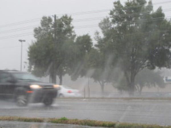
Tampa Bay area residents are being urged to keep an eye on the skies as heavy storms move through the region.
The National Weather Service in Ruskin says the Bay area is in for a deluge that could last through the morning on Wednesday. The good news is conditions are anticipated to clear out in time for a sunny, but brisk Thanksgiving.
In order to get through to Thursday, however, the Bay has to endure a day and a half of potentially heavy storms.
Find out what's happening in Land O' Lakesfor free with the latest updates from Patch.
Meteorologist Tyler Fleming explained that there’s a cold front moving through the area, along with a low pressure system from the Gulf of Mexico.
“(There’s) a lot of deep moisture that’s leading to a lot of heavy rain,” Fleming said. “There’s a potential for some minor river flooding and urban flooding situations.”
Find out what's happening in Land O' Lakesfor free with the latest updates from Patch.
Fleming also said there’s potential for some strong to severe thunderstorms, along with isolated tornado threats. While no tornado warnings have been issued for the Bay area, Tuesday morning’s storms have prompted them in the Melbourne area, Fleming noted.
Many parts of Tampa Bay are likely to see 1 to 4 inches of rain through Wednesday morning. Some areas may witness as much as 5 inches, Fleming said, which is very rare for this late in November.
As the storms move through, Fleming said motorists should exercise caution on the roads.
For a complete look at the forecast, visit the National Weather Service online.
Get more local news delivered straight to your inbox. Sign up for free Patch newsletters and alerts.