Weather
Massive Tornado Watch Issued For South Florida Until Midnight
As Hurricane Irma barrels toward the south Florida coast, a huge tornado watch has been issued for a large area in the state.

MIAMI, FL — A huge and possibly unprecedented tornado watch has been issued for the entire southern portion of Florida stretching from Lake Okeechobee on the northern end all the way down to Everglades National Park.
On the East Coast, that includes everything from Jupiter at the northern end down past Miami to near Key Largo. On the Gulf side, that warning stretches from Port Charlotte and Fort Myers down through Naples and beyond.
For the full tornado watch map, see the warning area embedded below:
Find out what's happening in Miamifor free with the latest updates from Patch.
The National Weather Service has issued a tornado watch until midnight for South Florida. pic.twitter.com/TwnHkyorCd
— 7 Weather (@7Weather) September 9, 2017
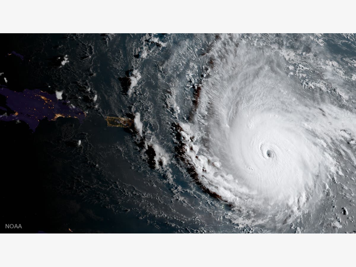
Hurricane Irma is expected to make landfall on the southern Florida coast Saturday evening, and then roll straight up through almost the entirety of the state.
Analysis: There's No Way Around Irma's Wrath For Florida
Find out what's happening in Miamifor free with the latest updates from Patch.
Cuba has taken some of the edge off the former category 5 storm, which has since been downgraded to a category 3 storm as of around noon on Saturday. Still, it is still classified as a major hurricane and could have devastating effects on the Florida coast.
By 11 a.m. Saturday, Irma, the behemoth that tore through the Caribbean, leaving at least 20 people dead in its wake, was packing maximum sustained winds of 125 mph. Irma was located about 175 southeast of Key West, moving west at 9 mph. (For more hurricane news or local news from Florida, click here to sign up for real-time news alerts and newsletters from Miami Patch, and click here to find your local Florida Patch. If you have an iPhone, click here to get the free Patch iPhone app.)
The hurricane warning for the Gulf Coast was extended Saturday morning to run from the tip of the state north to the Aucilla River Hurricane warnings mean that hurricane conditions are expected in the warning area within the next 36 hours. The storm surge warning for the west coast extended from the southern tip of the peninsula to Suwanee River. Storm surge warnings mean storm surges are anticipated within the warning area over the next 36 hours.
Patch editor Sherri Lonon contributed to this report
Get more local news delivered straight to your inbox. Sign up for free Patch newsletters and alerts.