Weather
Tornado Watch Issued for Miami Area
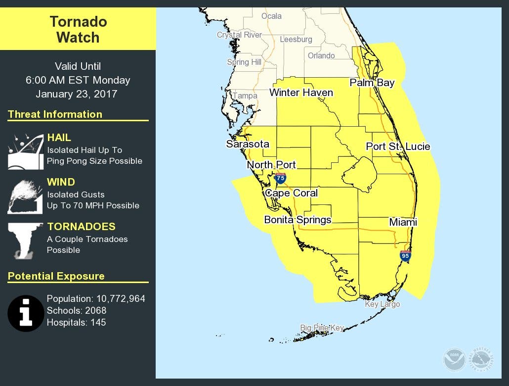
The National Weather Service has issued a watch for overnight Sunday into Monday morning.


MIAMI — The National Weather Service has issued a tornado watch for the greater Miami area and Broward County starting at about 1 a.m on Monday morning as a strong cold front moves through on Sunday evening.
The worst conditions in the Miami and Fort Lauderdale areas are likely to occur between 1 a.m. and 5 a.m., according to Tony Reynes, senior forecaster with the National Weather Service in Miami. In nearby Palm Beach County, the worst conditions are likely to occur between 12 a.m. to 4 a.m.
"These time windows reflect the timing of worst of conditions, and does not mean it will last that entire duration but likely will occur for 1-2 hours within those time frames," Reynes explained at 10 p.m. on Sunday.
Find out what's happening in Miamifor free with the latest updates from Patch.
Miami Beach police are advising motorists to pull over if their vehicle is hit by flying debris during the storm. "If your vehicle is hit by debris while driving, pull over and park," police said. "Stay in the car, put your head down below the windows; cover your head."
Miami Beach police also said that officials will be offering shelter to the city's homeless community overnight Sunday ahead of the storm.
Find out what's happening in Miamifor free with the latest updates from Patch.
The National Weather Service is asking everyone in South Florida to remain alert.
"We're advising everyone in South Florida to remain alert as severe storms/tornado warnings have already been issued for Central Florida earlier this evening," Reynes said.
Get more local news delivered straight to your inbox. Sign up for free Patch newsletters and alerts.