Weather
Tropical Development Chances Rise As Record FL Flooding Continues
Record rainfall and flooding continue across Florida as forecasters warn a coastal low could develop into a tropical or subtropical system.


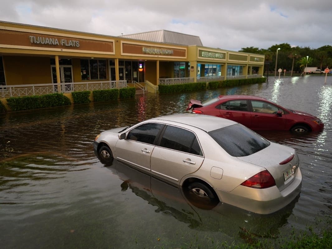
The chances of tropical or subtropical development off Florida's Atlantic coast have increased, but the more immediate concern for much of the state is the record rainfall and widespread flooding many areas have already seen in recent days.
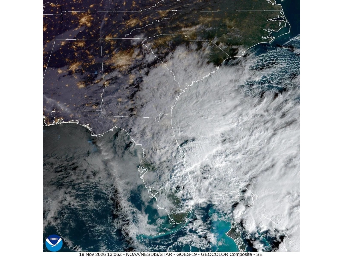
A broad area of low pressure is now located near Florida's east-central coast, producing disorganized showers and thunderstorms extending from the peninsula east-southeastward over the Atlantic, according to the National Hurricane Center's Friday morning Tropical Weather Outlook.
The system has a 30 percent chance of developing into a tropical depression or storm within two days and a 50 percent chance of strengthening within seven days.
Find out what's happening in Miamifor free with the latest updates from Patch.
Forecasters expect the low to move generally north to north-northeast, near or just offshore of the southeastern United States coast through the weekend.
The potential tropical storm comes close to the end of the Atlantic hurricane season, which is over on Nov. 30. It’s been an exceptionally slow season, with only 10 named storms, and just one hurricane. The next named storm of the season would be Kyle.
Find out what's happening in Miamifor free with the latest updates from Patch.
Regardless of whether this current low-pressure area develops into a named storm, the system is expected to bring strong, gusty winds, dangerous surf, rip currents and coastal flooding along portions of the Southeast and mid-Atlantic coasts into early next week, the NHC said.
Heavy rainfall and flash flooding are expected to continue across portions of the Florida peninsula Friday, with the potential for the rain threat to spread northward toward the Carolinas and mid-Atlantic over the weekend.
Parts of Florida's east coast are already dealing with significant flooding following multiple rounds of heavy rainfall this month.
The U.S. Geological Survey reported Thursday that some areas of east-central Florida that received more than 20 inches of rain during a record-setting early November storm had picked up another 5 to 10 inches on Tuesday and Wednesday.
The St. Johns River near Cocoa also surpassed its previous record peak water level by 0.9 feet, according to the USGS, which has 73 years of measurements at that location.
Extensive flooding along the St. Johns River is expected to continue, with additional rainfall potentially pushing river levels higher into the weekend and early next week, the National Weather Service said in a Friday morning Flood Statement.
In Brevard County on Thursday, people with trailers braved knee-deep water to rescue dozens of horses and other animals at the Blue Lake Equestrian Center, an animal hospice and boarding facility in Cocoa. The animals were taken to a dry pasture elsewhere.
First responders conducted nearly 100 high-water rescues across the county, and those numbers continued to climb, Sheriff Wayne Ivey said. The city of Palm Bay conducted mandatory evacuations for some residents of a mobile home community. Shelters were opened for residents forced from their homes.
Nearly 200 Florida National Guard personnel and 50 high-water vehicles have been deployed to assist communities dealing with the flooding, according to the Florida Division of Emergency Management.
The rainfall has also shattered November records in several Florida communities. Melbourne recorded 5.34 inches of rain Thursday, breaking its previous daily precipitation record of 2.80 inches set in 1987, according to the National Weather Service.
Melbourne's November rainfall total had reached 22.59 inches through Thursday, far exceeding its 1991-2020 November average of 1.63 inches through that date, the NWS Friday morning Climate Report said. The report lists the city’s precipitation records dating back to 1939.
The NWS Melbourne office warned Friday that Brevard and Volusia counties face a high risk of excessive rainfall and dangerous flash flooding, with slight to moderate risks extending farther south and across the interior.
A Flood Watch remained in effect through Friday evening.
“Another day of ‘HIGH’ flood threat along the Florida East Coast from Jacksonville down to Melbourne with the highest threat from Daytona down to the Space Coast,” Denis Phillips, chief meteorologist for Tampa Bay 28, wrote in a social media post.
Forecasters expect an additional 2 to 4 inches of rain across much of the region through Saturday, with 4 to 6 inches possible along the Volusia and Brevard coasts. Isolated higher amounts are possible.
“A slow-moving, persistent ‘mega-band’ of heavy rain and storms will stall over the northern parts of Central Florida” on Friday afternoon and evening, Fox 35’s Noah Bergren wrote in a social media post.
He added, “Seminole, Volusia, Flagler, and Orange Counties face the biggest threat for flash flooding and major rain totals during the second half of Friday. I still think things can get really bad with 10-20” maybe isolated higher totals possible in parts of these counties Friday afternoon and evening exclusively
The NWS also warned that already saturated ground could worsen existing flooding.
Strong easterly to northeasterly winds are expected to produce rough surf and potentially significant beach erosion. A high risk of dangerous rip currents also remains in place, with a High Surf Advisory extending through Saturday.