Community Corner
Cold Front Brings On Again, Off Again Rain
Tampa Bay area residents shouldn't look for the temperatures to drop too much.

Bay area residents looking for a reprieve from the rain might get it Thursday, but they shouldn’t count on it lasting too long.
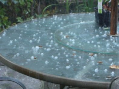
A cold front moving through the Tampa Bay area is to blame for the buckets falling from the sky, according to the National Weather Service. That front is expected to bring rain throughout the day Wednesday and into the evening hours. Conditions are anticipated to dry out a bit Thursday as rain chances drop to about 30 percent, but the reprieve is only temporary.
“(It should be) pretty rainy again on Friday,” meteorologist Robert Garcia said. “I wouldn’t be watering my lawn any time this week.”
Find out what's happening in New Port Richeyfor free with the latest updates from Patch.
Rain chances remain fairly strong going into the weekend, as well, with Saturday bringing a 50 percent chance and Sunday 30 percent.
While that “cold” front is dumping lots of rain on the region, Garcia said it’s not anticipated to drop temperatures all that much. Highs throughout the week are forecast in the mid to upper 80s with lows in the lower 70s.
Find out what's happening in New Port Richeyfor free with the latest updates from Patch.
Although no official flood watches or warnings are in effect as of yet, residents in urbanized areas should keep an eye out for localized street flooding as the front moves through.
For a complete look at Tampa Bay weather, visit the National Weather Service online.
Get more local news delivered straight to your inbox. Sign up for free Patch newsletters and alerts.