Community Corner
Winds Pick Up as Irene Sails Past Florida
Pinellas beaches have been spared the worst of the major hurricane, but gusting winds are expected to last into the weekend.

That breeze in the air is Hurricane Irene blowing past Florida on its way up the East Coast.
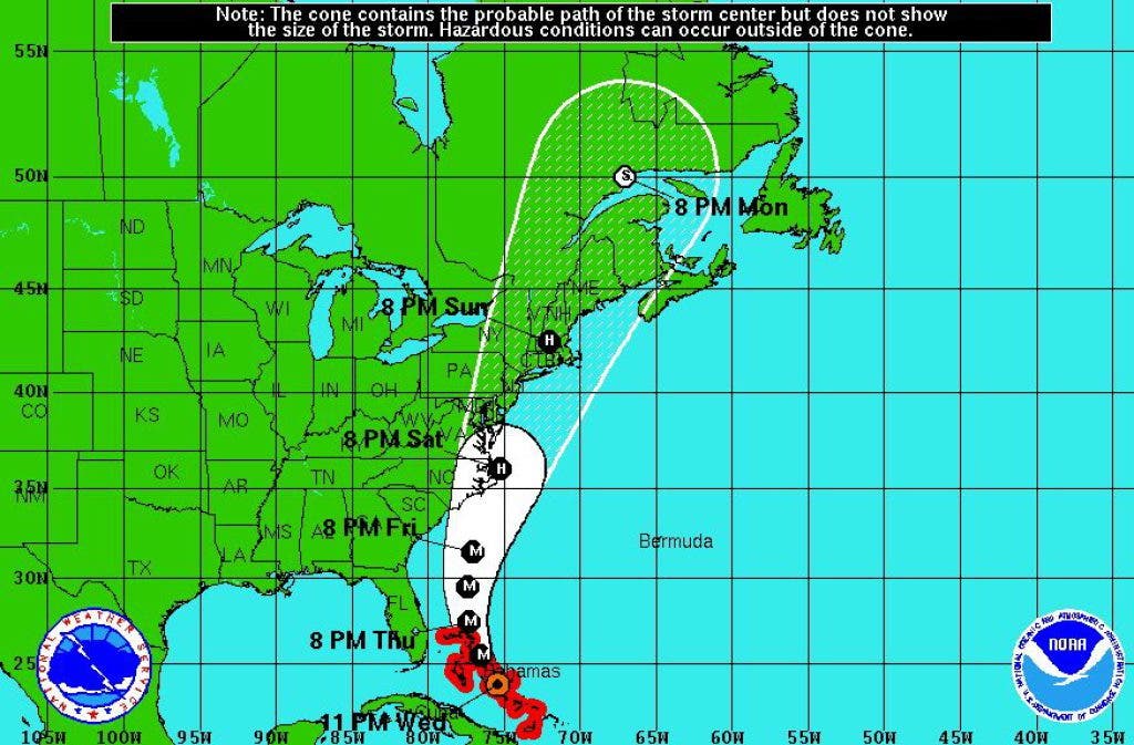
The storm moved through the central Bahamas on Wednesday and is picking up speed and strength in the Atlantic Ocean as it churns toward the Carolinas. The latest forecast track from the National Hurricane Center in Miami projects Irene will make landfall in coastal North Carolina on Saturday afternoon. Forecasters expect tropical storm or hurricane watches to begin in the Carolinas today.
Even though Irene is bypassing Florida, tropical-storm-force winds are extending up to 255 miles from the center of the storm, according to the National Hurricane Center. To put that in perspective, 255 miles is slightly farther than the distance between Tampa and Key West.
Find out what's happening in Pinellas Beachesfor free with the latest updates from Patch.
The local seven-day forecast from the National Weather Service calls for strong winds and occasional thunderstorms in the Tampa Bay area through Sunday, with gusts peaking near 30 mph on Friday. Conditions are expected to return to normal at the start of the week.
Florida emergency management officials suggest that residents take lawn furniture and other landscape items indoors as a precaution as the storm passes, and remove any tree branches or other debris in the yard that could be displaced by wind. Garage doors are particularly susceptible to wind and may need to be reinforced for hurricane season.
Get more local news delivered straight to your inbox. Sign up for free Patch newsletters and alerts.