Weather
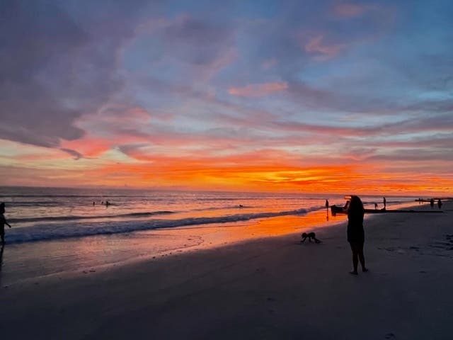
Here's The Weather Outlook For Florida Labor Day Weekend
Expect periodic thunderstorms but, overall, the weather forecast calls for a sunny Labor Day weekend in Florida.

FLORIDA — Florida's weather can be downright schizophrenic in the summer. One moment, a tropical downpour will flood streets and cause 100-year-0ld shallow-rooted live oak trees to topple over. Ten minutes later, the sun is shining and there's not a cloud in the sky.
Then there's the ever-present threat of hurricanes any time between June 1 and Nov. 30.
Just when you think Florida is out of the woods, a storm will suddenly take a turn and bear down on Florida's coast, sending residents scurrying to purchase plywood to board up windows.
Find out what's happening in Tampafor free with the latest updates from Patch.
When it comes to making weekend plans, Floridians have become accustomed to last-minute changes. And no veteran Floridian would dare leave home without an umbrella and sun block.
This is especially true for Labor Day weekend. Labor Day weekend is smack in the middle of what is historically the busiest portion of the Atlantic hurricane season.
Find out what's happening in Tampafor free with the latest updates from Patch.
Since 1851, at least 25 hurricanes have hit or brushed North America on Labor Day weekend, including seven in Florida, according to the National Oceanic and Atmospheric Administration.
This includes the Great Labor Day Hurricane of 1935, the eighth-deadliest hurricane in the continental United States. The Category 5 hurricane slammed into the Florida Keys with 185 mph winds, killing more than 500 people.
Hurricane Easy didn't live up to its name. It traveled along the western Florida coast as a growing hurricane on Labor Day Sept. 5, 1950, and then completed two loops in the northeastern Gulf of Mexico. One of those loops passed near the town of Cedar Key, pummeling the fishing village with 125 mph winds, destroying more than half of the homes.
Hurricane David pounded West Palm Beach on Sept. 3, 1979, before making landfall near Savannah, Georgia, with 100 mph winds.
On Sept. 2, 1985, Hurricane Elena made landfall near Biloxi, Mississippi. But before it reached Mississippi, it meandered up Florida's east coast, causing the evacuation of more than 500,000 people in Tampa Bay and other coastal areas, and drenching Apalachicola with 11 inches of rain.
Hurricane Frances hit Port St. Lucie on Sept. 5, 2004, before making a second landfall in the Florida Panhandle.
On Aug. 28, 2016, Hurricane Hermine made landfall in the Big Bend area but damaged 2,694 structures and caused $102 million in Citrus County. About 325,000 people were left without electricity, including 80 percent of Tallahassee.
Finally, there was Tropical Storm Gordon, which formed near the Florida Keys on Aug.30, 2018, killing two residents before making landfall west of the Alabama-Mississippi border.
With that in mind, the National Hurricane Center is keeping a close eye on Hurricane Larry, now located about 1,320 miles east of the Leeward Islands with maximum sustained winds of 100 mph and higher gusts, making Larry officially a Category 2 hurricane.
Larry is moving toward the west-northwest at about 16 mph and this motion is expected to continue over the weekend with a turn to the northwest by early next week.
"Over the course of the day, Larry's appearance has become more impressive," Philippe Papin, a forecaster for the National Hurricane Center, said. "The eye has been gradually becoming better defined on visible satellite imagery as the center cloud top temperature has been warming on the infrared channel. Several microwave passes have been received since the last advisory. The most recent pass suggested the eye and surrounding eye wall convection is becoming better defined."
Larry has remained on a fairly steady track to the west-northwest throughout Friday.
Papin said it's too soon to determine what impacts Larry may pose to the island of Bermuda, but, with the recent improvement in Larry's structure on satellite imagery, the hurricane may be starting another rapid intensification cycle.
"It should be noted that the majority of the guidance also shows Larry becoming a very large hurricane, with a significant expansion," he said.
This means Larry could become a major hurricane this weekend with tropical storm-force winds extending outward up to 150 miles from the center of the hurricane.
As of now, the National Weather Service isn't anticipating any major weather events for Labor Day weekend 2021.
Here's the general forecast for Florida:
Saturday, Sept. 4
There's a 50 percent chance of showers and thunderstorms but it should be mostly sunny with a high near 91 degrees and 5 mph winds in the morning from the north-northeast.
Saturday night will be mostly clear with a low of around 72 degrees and 5 mph winds from the northeast.
Sunday, Sept. 5
There's a 40 percent chance of showers and thunderstorms. In between, it will be sunny with a high near 92 degrees and 5 mph winds from the north-northwest in the afternoon.
Sunday night will be mostly clear with a low around 72 degrees and 5 mph winds from the southwest.
Monday, Sept. 6
There's a 40 percent chance of showers and thunderstorms. In between, it will be sunny with a high of 92 degrees and 5 mph winds from the west in the morning.
Monday night will be partly cloudy with a low around 73 degrees and 5 mph winds from the west-southwest.
Get more local news delivered straight to your inbox. Sign up for free Patch newsletters and alerts.