Weather
Hurricane Fiona: What's The FL Forecast After Puerto Rico Pummeled?
Hurricane Fiona, which has hammered Puerto Rico, is expected to strengthen in the next few days and become a major hurricane by Wednesday.


FLORIDA — While Florida managed to dodge another hurricane this season, residents of Puerto Rico and the Dominican Republic aren't so lucky. The Category 1 storm has 85 mph winds Monday, but is expected to be a major hurricane by Wednesday with winds over 111 mph, forecasters said.
The latest update has Fiona turning north to northeast by Wednesday and spinning away from the East Coast.
"Fiona will likely interact with the incoming cold front later this week, causing the storm to pick up speed and turn northeastward, potentially passing close to Bermuda," AccuWeather Senior Meteorologist Dan Pydynowski said, noting that this northeastward curve is a common track for Atlantic hurricanes.
Find out what's happening in Tampafor free with the latest updates from Patch.
After making landfall in Dominican Republic around 3:30 a.m. Monday, National Hurricane Center forecasters said Hurricane Fiona now lies about 35 miles from southeast of Samana, Dominican Republic, moving northwest at 8 mph.
This general motion is expected to continue through Monday night, followed by a sharp turn toward the north-northwest on Tuesday and then to the north-northeast on Wednesday and Thursday, missing Florida.
Find out what's happening in Tampafor free with the latest updates from Patch.
AccuWeather meteorologists said Florida's reprieve from Fiona is due to a plunge of cool air associated with a cold front. The cold air is expected to arrive in the Northeast just in time for the official start of fall on Thursday, Sept. 22, shielding the U.S. from direct impacts from Fiona.
Some strengthening is expected during the next few days after the hurricane emerges over the southwestern Atlantic, and Fiona is forecast to become a major hurricane by Wednesday, said the National Hurricane Center.
AccuWeather meteorologists said there is the potential for Fiona to reach Category 4 status just southwest of Bermuda and east of the Bahamas with sustained winds from 130 to 156 mph.
Fiona is the fifth named storm and the third hurricane of the 2022 hurricane season. Hurricane Danielle peaked at hurricane intensity twice over the open waters of the North Atlantic in early September. Earl was the second tropical storm to strengthen into hurricane force. It reached Category 2 strength over the central Atlantic in early September, AccuWeather reported.
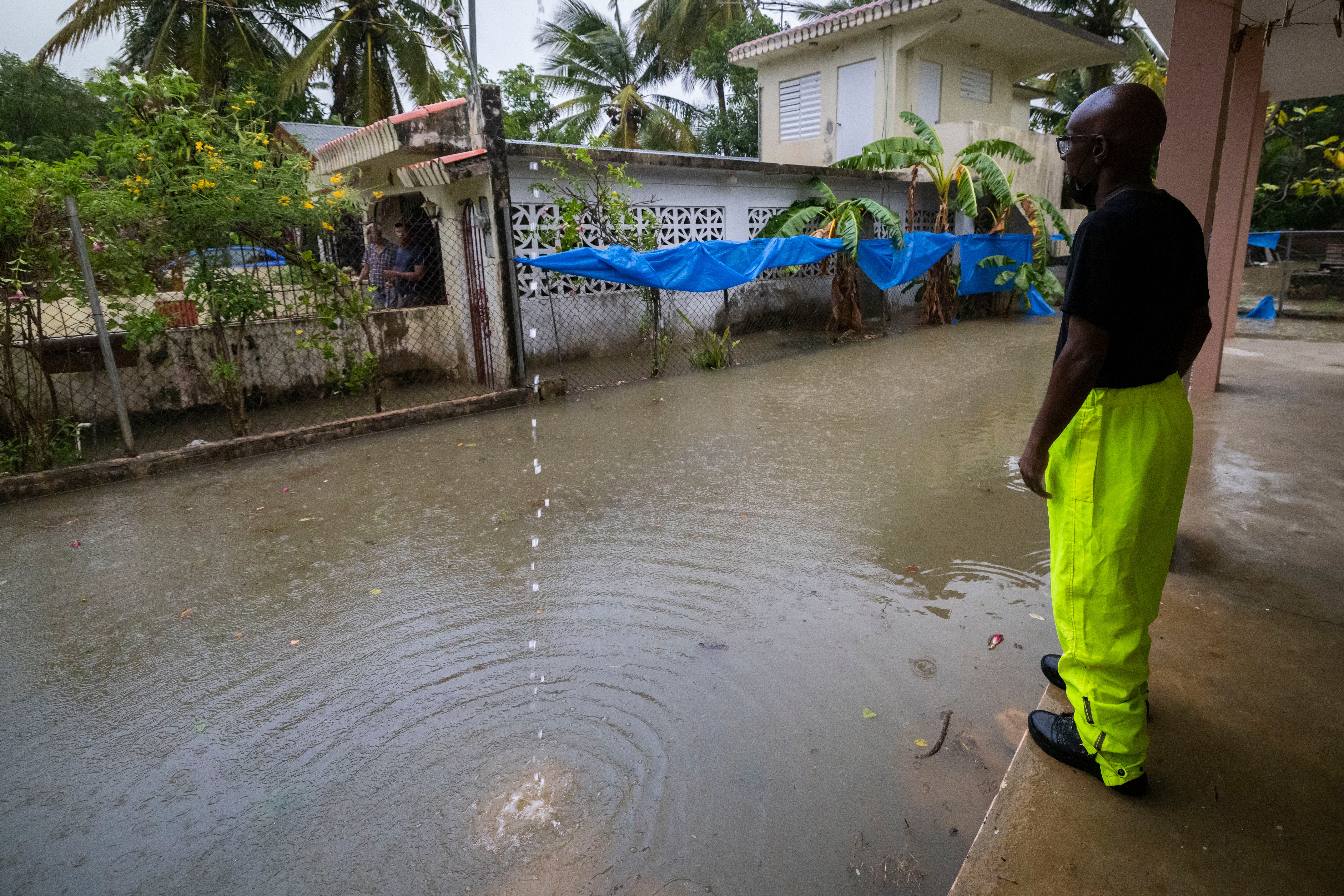
The hurricane center said Hurricane Fiona made landfall near Punta Tocon, Puerto Rico, Sunday night as a Category 1 hurricane with maximum sustained winds of 90 mph, and is continuing to barrage the island with high winds and heavy rains, knocking out power on the entire island (about 1.5 million customers) and "causing catastrophic flooding."
The hurricane center said Fiona then made its way to the Dominican Republic with maximum sustained winds of 85 mph.
The governor of Puerto Rico, Pedro Pierluisi, said it's too early to report on fatalities and the extent of hurricane damage. However, President Joe Biden has declared a federal disaster for the island.
A worker of the Loiza municipality calls on residents to evacuate due to imminent flooding due to the rains of Hurricane Fiona, in Loiza, Puerto Rico, Sunday.
RELATED STORIES:
- Hurricane Season 2022 Predicted To Be 'Above Normal': NOAA
- 2022 Hurricane Names List Released For Atlantic Season
Forecasters at the National Oceanic Atmospheric Administration's Climate Prediction Center said in their annual prediction for the 2022 Atlantic hurricane season, which runs June 1 to Nov. 30, that the season should be active.
According to this year's forecast, the ongoing La Niña, in addition to above-average ocean temperatures, means there's a 65 percent chance the 2022 hurricane season will be above normal.
For the 2022 season, forecasters are predicting 14 to 21 named storms with winds of 39 mph or higher. Of those, anywhere from six to 10 of the storms could become hurricanes with winds of 74 mph or higher.
Forecasters predicted this year's season will spawn anywhere from three to six major hurricanes rated a category 3 or higher as the most active months of the hurricane seasons — September to November — get underway.
Get more local news delivered straight to your inbox. Sign up for free Patch newsletters and alerts.