Weather
Special Thunderstorm Statement Issued By National Weather Service
Strong thunderstorms will affect portions of Manatee, Hillsborough and Sarasota counties through 7:15 p.m.

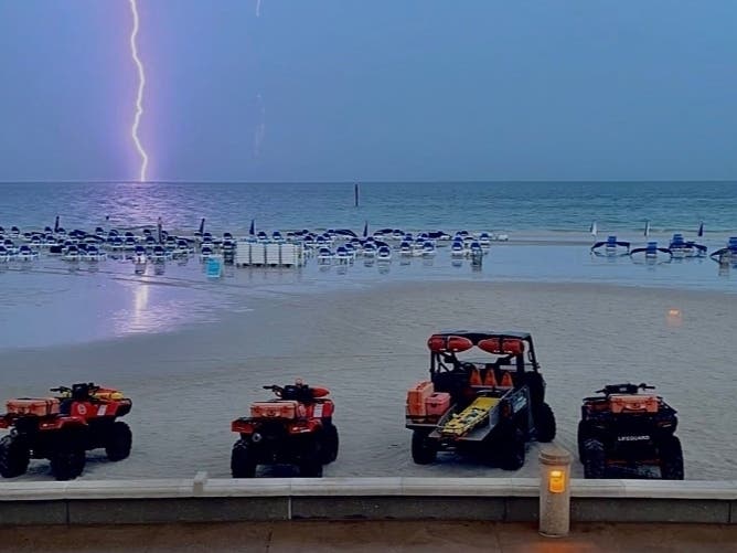
TAMPA BAY, FL — Strong thunderstorms will affect portions of south-central Pasco, northwestern Manatee, central Hillsborough and northwestern Sarasota counties through 8:15 p.m.
At 7:12 p.m., Doppler radar was tracking strong thunderstorms from Pebble Creek to near Greater Sun Center to 6 miles south of Gulf Gate Estates. These storms were nearly stationary.
Wind gusts up to 50 mph are anticipated. Gusty winds could knock down tree limbs and blow around unsecured objects.
Find out what's happening in Tampafor free with the latest updates from Patch.
Affected locations include Tampa, Sarasota, Bradenton, Temple Terrace, Palmetto, Lutz, Brandon, Fish Hawk, Greater Sun Center, South Gate Ridge, Lake Sarasota, Saint Armands Key, North Sarasota, Palm River-Clair Mel, Memphis, Tampa International Airport, East Lake-Orient Park, West Samoset, Southgate and Gulf Gate Estates.
Get more local news delivered straight to your inbox. Sign up for free Patch newsletters and alerts.