Weather
Another Round Of Severe Weather, Storm Watch Issued For Chicago Area
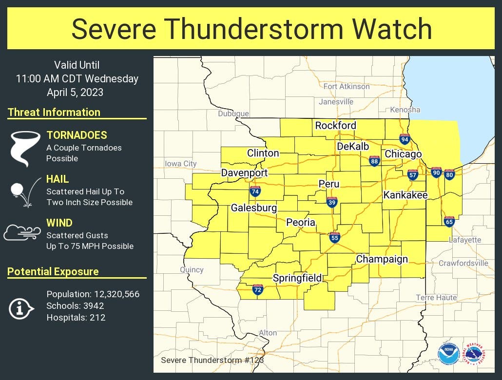
Threats with this round of severe weather includes tornadoes, hail and scattered wind gusts up to 75 mph.

ILLINOIS — Another round of severe weather is possible Wednesday, and a severe thunderstorm watch has been issued for most of the Chicago area.
The watch is in effect until 11 a.m. Wednesday for all of northern Illinois including Cook, DeKalb, DuPage, Grundy, Kane, Kankakee, Kendall, Lake, La Salle, McHenry and Will counties.
Threats with this round of severe weather includes tornadoes, hail and scattered wind gusts up to 75 mph.
Find out what's happening in Across Illinoisfor free with the latest updates from Patch.
Several warnings, including tornado and severe thunderstorm, have already been issued for parts of the area on Wednesday morning.
The severe threat will exit the area by early Wednesday afternoon.
Find out what's happening in Across Illinoisfor free with the latest updates from Patch.
AccuWeather gave an 89 percent probability of thunderstorms for Joliet on Wednesday. The private forecaster said there will be "a few a.m. t-storms, some severe" and that storms could have "flooding downpours, hail, damaging wind gust and an isolated tornado."
Temps on Wednesday will be very mild, with highs of 73 degrees expected. Non-thunderstorm wind gusts of 40 to 50 mph are expected as well, according to the weather service.
A wind advisory is also in effect until 4 p.m. Wednesday for DeKalb, Kane, DuPage, La Salle, Kendall, Grundy, Cook and Will counties. Gusty winds could blow around unsecured objects, and a few power outages are possible, according to the weather service.
Get more local news delivered straight to your inbox. Sign up for free Patch newsletters and alerts.