Weather
'Classic Pattern' Of Heat, Chance Of Storms This Week For Illinois
The week will start cooler and rainy on Monday, before temperatures climb back into the 90s by the end of the week.

ILLINOIS — Monday will begin with a cooler and rainy start to the week, before things begin to dry out and temps get warmer, according to the National Weather Service.
Monday has a high of 77 degrees, and "breezy northwest winds and waves of showers will be the norm," the weather service said on Twitter.
Showers and a few storms will move from north to south on Monday afternoon, according to the weather service. A few storms could have gusty winds, which could down small tree limbs.
Find out what's happening in Across Illinoisfor free with the latest updates from Patch.
Rain will end by Monday night, and temps on Tuesday are back in the 80s, with a high of 83. Weather will be dry and sunny on Tuesday and Wednesday, which has a high of 86 degrees, according to the weather service.
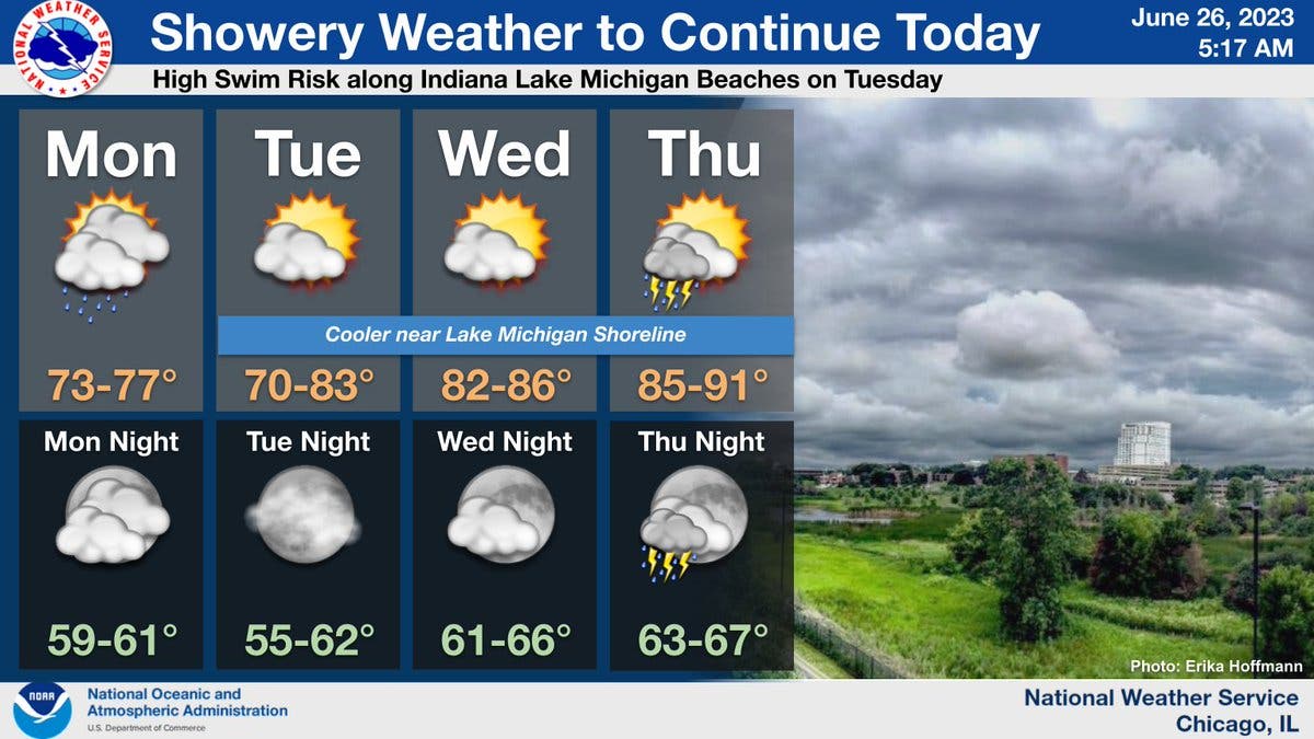
Storms are possible Thursday, as a high of 91 degrees is expected. Hot temperatures will continue on Friday, with a high of 92, and storm chances will continue to end the week.
Find out what's happening in Across Illinoisfor free with the latest updates from Patch.
The weather service said "a classic summertime pattern of building heat and humidity, but also chances for episodic thunderstorms" arrives Wednesday through Friday.
The highest chances for heat and storms is Thursday, according to the weather service.
Get more local news delivered straight to your inbox. Sign up for free Patch newsletters and alerts.