Weather
Storms, Damaging Winds Possible; Severe Thunderstorm Watch Issued
Find out what time storms could hit. Plus, a cold front on Thursday could bring more storms, high swim risk along Lake Michigan.

ILLINOIS — A hot and muggy Wednesday is expected before storms move into the area in the afternoon and evening, according to the National Weather Service. Storms are most likely to move into the area between 2 and 8 p.m.
A severe thunderstorm watch is in effect until 9 p.m. Wednesday for Cook, DuPage, Ford, Grundy, Iroquois, Kane, Kankakee, Kendall, Lake, Livingston and Will counties.
For the south suburbs, there is also a heat advisory issued for Grundy, southern Cook, and Will counties until 7 p.m. Wednesday. The weather service said high temperatures and humidity may cause heat illnesses to occur.
Find out what's happening in Across Illinoisfor free with the latest updates from Patch.
Peak heat index values could exceed 105 degrees, especially for areas south of Interstate 80, according to the weather service.
AccuWeather calls for a "gusty thunderstorm" Wednesday and partly sunny and cooler weather Thursday.
Find out what's happening in Across Illinoisfor free with the latest updates from Patch.
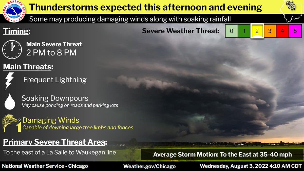
Storms will develop Wednesday afternoon, and will bring a threat for severe weather and heavy rain, the weather service said. Storms will spread south and east through the evening, and the primary severe threat area includes much of the Chicago area.
The main severe threat will be damaging wind gusts, which could be capable of downing tree limbs and fences, according to the weather service.
A cold front will move in on Thursday, shifting winds to the north and creating the potential for high waves and dangerous conditions on Lake Michigan.
Get more local news delivered straight to your inbox. Sign up for free Patch newsletters and alerts.