Weather
Freezing Rain, Floods Possible As Storms Move Into Illinois Wednesday
Some areas could see a freezing rain threat, while others could face heavy rain and icy roads.

ILLINOIS — A large storm system will move into the Chicago area on Wednesday, bringing rain or freezing rain and wind gusts over 40 mph, according to the National Weather Service.
Tuesday will be dry and sunny before the storm system moves in, the weather service said. There is a high of 42 degrees, and a chance of rain late Tuesday night for south of Interstate 80.
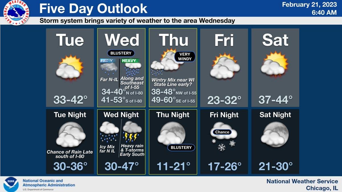
On Wednesday, most of the area will fall under a heavy rain threat, with the north suburbs of Chicago, like the Waukegan area, possibly facing a freezing rain threat, according to the weather service.
Find out what's happening in Across Illinoisfor free with the latest updates from Patch.
The weather service said that periods of freezing rain, mixed with sleet at times, will begin Wednesday and Wednesday evening. Accumulating ice and sleet is possible, especially near the Wisconsin state line.
Other areas could see periods of heavy rain with a chance of localized flooding, and isolated thunderstorms are even possible.
Find out what's happening in Across Illinoisfor free with the latest updates from Patch.
For the Joliet area, AccuWeather gave a forecast of 1.1 inches of rain with 12 hours of precipitation on Wednesday.
Then, on Thursday, wind gusts over 40 mph are possible, and towns northwest of Interstate 55 will see a high of 48, while areas southeast of I-55 will see highs of 60 degrees, according to the weather service.
Colder temperatures will move into the area on Thursday night, and the high for Friday will be 31 degrees. There is also a chance of snow on Friday night.
Temperatures will begin to warm again for the weekend, and Saturday has a high of 43, according to the weather service.
Get more local news delivered straight to your inbox. Sign up for free Patch newsletters and alerts.