Weather
Mild Temps Continue, Rain and Snow Possible Thursday For Chicago Area
Highs on Wednesday could hit 60 degrees.

ILLINOIS — Mild temperatures will continue through the week, but "more active" weather will begin after a quiet Monday, according to the National Weather Service Chicago.
Monday will have a high of 55, and should remain dry into the night.
However, rain and wind will move into the area on Tuesday afternoon and night, the weather service said. Tuesday will still be mild with a high of 54 degrees, but wind gusts could be up to 40 mph.
Find out what's happening in Across Illinoisfor free with the latest updates from Patch.
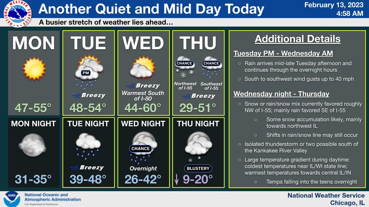
The rain will continue through the overnight hours into Wednesday. Wednesday will be breezy and will have a high of 60 degrees, according to the weather service.
Then, on Wednesday night, weather may give a bit of whiplash as rain and snow move into the Chicago area. On Thursday, the weather service said a snow or rain/snow mix is likely northwest of Interstate 55, and rain is likely southeast of I-55.
Find out what's happening in Across Illinoisfor free with the latest updates from Patch.
There will be a large temperature range during the day on Thursday, which has a high of 51, the weather service said on its Twitter. Colder temps will be seen need the Illinois-Wisconsin state line, while the warmest temps will be toward central Illinois.
AccuWeather said there could be "a shower in sports in the morning following by a bit of snow and rain at times in the afternoon" on Thursday for the Joliet area. The private forecaster gave a prediction of .09 inches of rain during the day, and .2 inches of snow on Thursday night.
Temps will be more seasonable on Friday, which has a high of 28 degrees, according to the weather service.
Get more local news delivered straight to your inbox. Sign up for free Patch newsletters and alerts.