Weather
Rain, Fog Expected Before Possible Snow Accumulation: Illinois Weather
Fog could reduce visibility to less than half a mile in the Chicago area. Drivers should prepare for longer travel times.

ILLINOIS — The first week of the new year will bring rain and temperatures near 40 degrees. Tuesday will start off foggy and rainy, and fog could actually persist through the evening, according to the National Weather Service.
The temperatures will vary on Tuesday, depending on if you live north or south of Interstate 80. For the north, the high is 52, and for the south, the high is 64, according to the weather service.
A warm front will "drape south" of I-80, and it will separate the warmer air from the cooler air to the north, the weather service said on Twitter. Thunderstorms, possibly severe, are possible for areas in the warmer air.
Find out what's happening in Across Illinoisfor free with the latest updates from Patch.
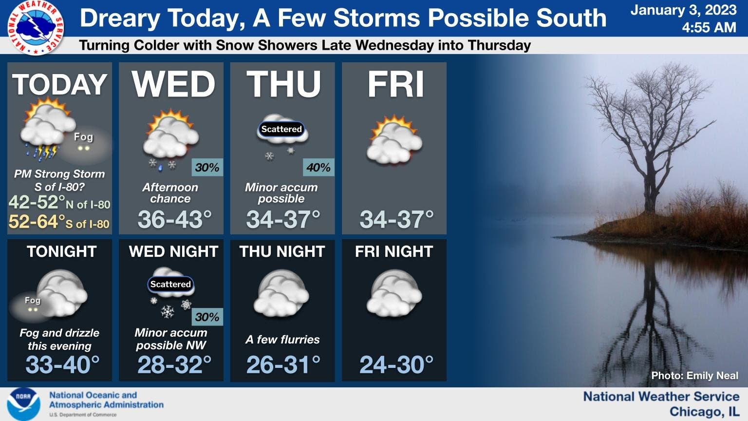
Wednesday will have a high of 43 degrees, and there is a chance of rain and snow in the afternoon, followed by scattered snow showers Wednesday night, according to the weather service.
Thursday could also see snow showers, with the possibility of minor accumulation, according to the weather service. The high for the day on both Thursday and Friday will be 37 degrees.
Find out what's happening in Across Illinoisfor free with the latest updates from Patch.
AccuWeather called for a "couple of snow showers" on Thursday; and the private forecaster gave a 55 percent probability for little to no accumulation, and a 42 percent chance for a coating to 2 inches of snow.
Friday will end the week with partly cloudy skies, and it should remain dry, according to the weather service.
Get more local news delivered straight to your inbox. Sign up for free Patch newsletters and alerts.