Weather
Repeated Downpours Could Lead To Flooding For Chicago Area
Also, dangerous swimming conditions are expected through Monday at Lake Michigan beaches.


A localized flooding threat is possible across the Chicago area, with repeated downpours possible Friday afternoon through Saturday morning, according to the National Weather Service.
The weather service said there is a chance of storms on Friday afternoon and night, and a few of the storms "may approach severe limits."
Temperatures will cool into the 70s over the weekend, with a high of 84 on Friday, 75 on Saturday and 78 on Sunday, according to the current forecast.
Find out what's happening in Across Illinoisfor free with the latest updates from Patch.
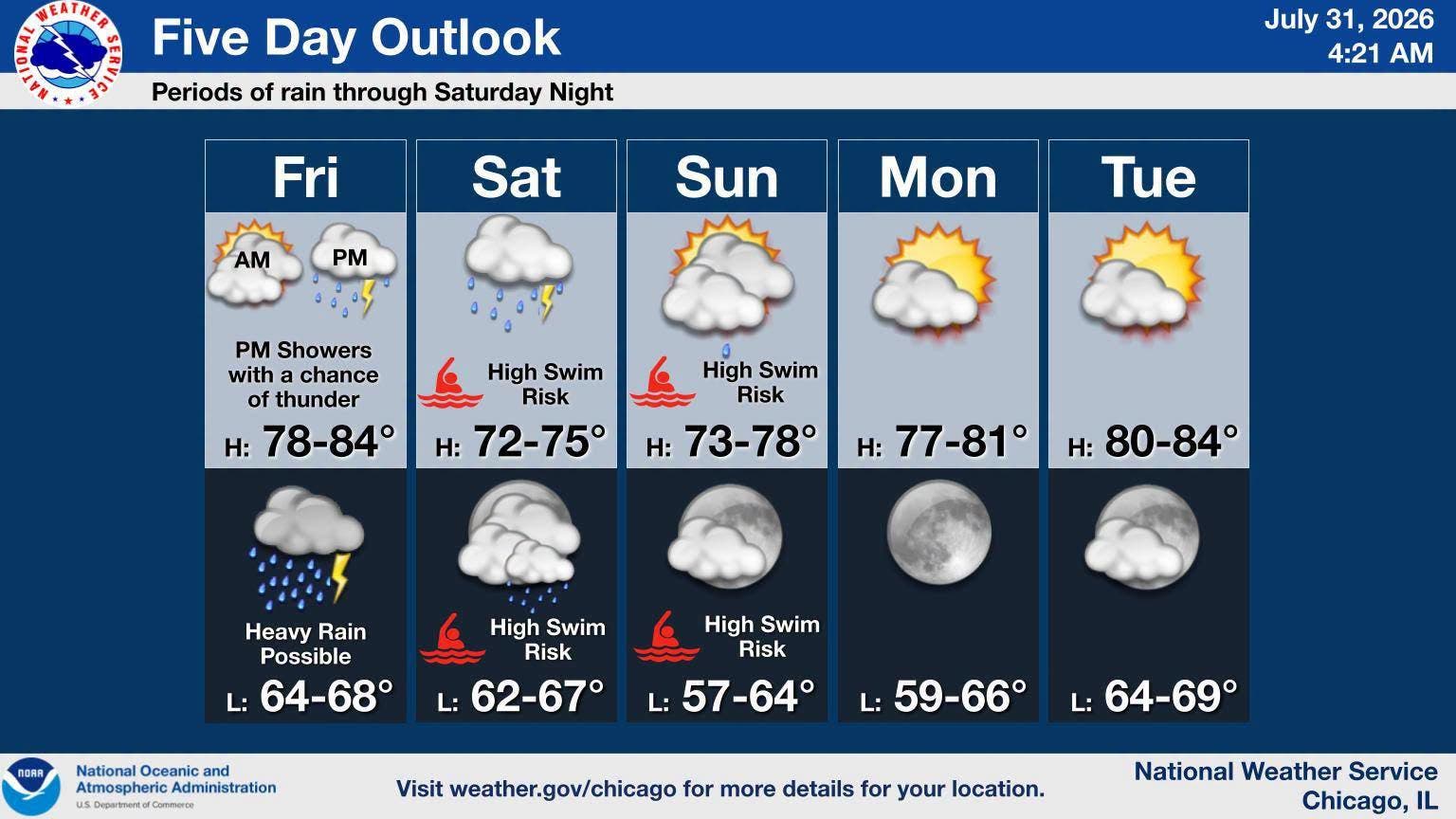
There is also a chance of storms on Saturday, but severe weather is not expected.
Repeated downpours could lead to localized rainfall totals in excess of two inches. Flooding of low-lying and poor draining areas is likely, and rises in river and creek levels may occur as well, the weather service said.
Find out what's happening in Across Illinoisfor free with the latest updates from Patch.
In addition to the flooding risk, there is a high swim risk through Monday morning for Lake Michigan beaches. Dangerous swimming conditions are expected, the weather service said.
Here's a more detailed look at the weather for the Joliet area, per the weather service:
FRIDAY: Showers likely, with thunderstorms also possible after 4 p.m. Cloudy, with a temperature falling to around 73 by 5 p.m. South wind around 10 mph, with gusts as high as 20 mph. Chance of precipitation is 70%. New rainfall amounts between a tenth and quarter of an inch, except higher amounts possible in thunderstorms.
FRIDAY NIGHT: Showers and possibly a thunderstorm. Low around 66. East wind around 15 mph, with gusts as high as 25 mph. Chance of precipitation is 100%. New rainfall amounts between three quarters and one inch possible.
SATURDAY: Showers and possibly a thunderstorm. High near 73. Northeast wind around 15 mph, with gusts as high as 30 mph. Chance of precipitation is 80 percent. New rainfall amounts between a half and three quarters of an inch possible.
SATURDAY NIGHT: A chance of showers and thunderstorms before 10 p.m., then a chance of showers between 10pm and 1 a.m. Mostly cloudy, with a low around 65. North northeast wind around 15 mph, with gusts as high as 30 mph. Chance of precipitation is 40%.
SUNDAY: Partly sunny, with a high near 75. North northeast wind around 15 mph, with gusts as high as 25 mph.
SUNDAY NIGHT: Mostly clear, with a low around 61.
Get more local news delivered straight to your inbox. Sign up for free Patch newsletters and alerts.