Weather
Threat Of Destructive Winds, Hail, Tornadoes Loom As Heat Index Climbs In Chicago Area
Peak heat index values in the upper 90s to locally 100 degrees are also possible.

Tuesday, Wednesday and Thursday will be hot and humid, and all will have a threat for severe weather, according to the National Weather Service.
Peak heat index values in the upper 90s to locally 100 degrees are possible.
"This will be the stickiest air of the year so far this season, so be sure to practice heat safety tips," the weather service advised. You should stay hydrated, wear light clothing, take frequent breaks in the shade or AC, and consider shifting outdoor activities, especially during the warmest park of the day.
Find out what's happening in Across Illinoisfor free with the latest updates from Patch.
The weather service said Wednesday will be the hottest day. Peak heat index values could be 101 degrees for Kankakee, 100 degrees for Chicago, Aurora and Joliet, and 99 degrees for Elgin and Waukegan.
There will also be multiple windows for severe weather, starting late Tuesday and last through Thursday.
Find out what's happening in Across Illinoisfor free with the latest updates from Patch.
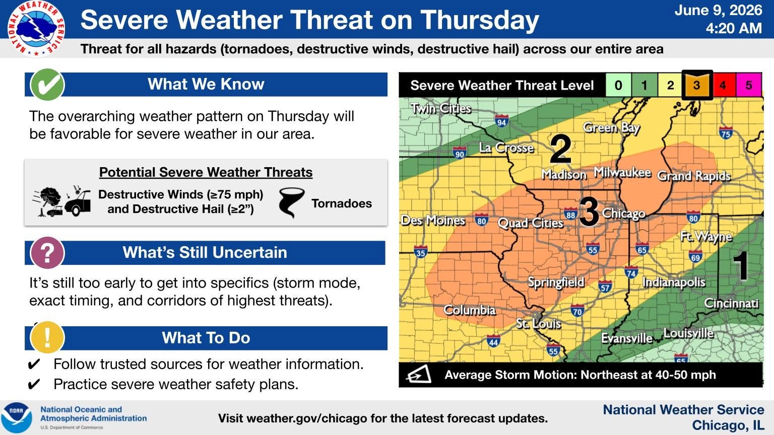
According to the weather service, the highest coverage and intensity of storms are favored on Thursday.
The weather service said Thursday has a level 3 of 5 severe weather threat, which includes destructive winds, hail and tornadoes.
The weather service noted that it's still too early to get into specifics for severe weather on Thursday, like exact timing of exact places of highest threats.
Get more local news delivered straight to your inbox. Sign up for free Patch newsletters and alerts.