Weather
'Soaking Downpours' Possible As 2 Rounds Of Storms Hit Chicago Area
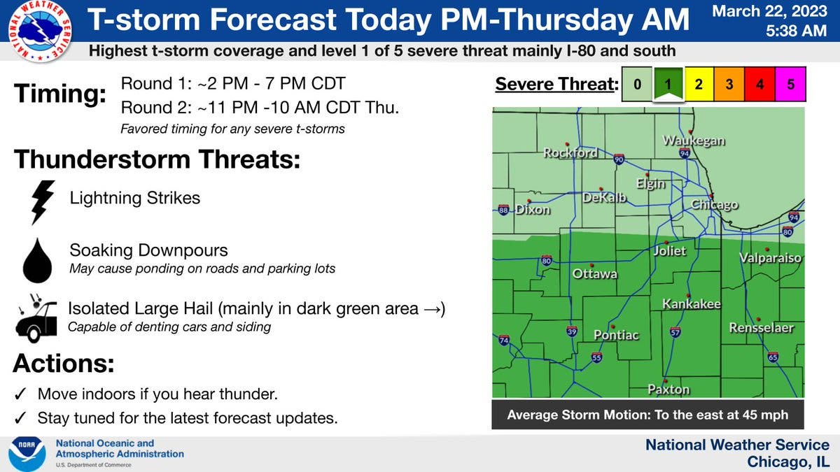
The first round of storms will move into the area on Wednesday afternoon, between 2 and 7 p.m., the weather service said.

ILLINOIS — Two rounds of storms will approach the Chicago area on Wednesday and into Thursday, potentially bringing soaking downpours, large hail and lightning strikes, according to the National Weather Service Chicago.
The first round of storms will move into the area on Wednesday afternoon, between 2 and 7 p.m., the weather service said.
The main threats with the storms will be damaging hail, gusty winds and soaking downpours.
Find out what's happening in Across Illinoisfor free with the latest updates from Patch.
AccuWeather gave a 35 percent probability for thunderstorms on Wednesday in Joliet. The private forecaster gave a forecast of .21 inches of rain over 3.5 hours.
The weather service said the greatest damaging hail threat will be along and south of Interstate 80. Hail could be up to 1 inch in diameter.
Find out what's happening in Across Illinoisfor free with the latest updates from Patch.
The second round of storms will be Wednesday night into Thursday, from 11 p.m. Wednesday to 10 a.m. Thursday. The highest thunderstorm coverage and potential severe weather threat is mainly I-80 and south, according to the weather service.
After storms on Thursday, temps will fall throughout the day on Thursday. The high for the day is 51 for areas north of I-80, and temps will be in the 40s on Friday.
Get more local news delivered straight to your inbox. Sign up for free Patch newsletters and alerts.