Weather
'Slushy Accumulations' Possible To End The Week: Illinois Weather
The Chicago area could see its first snowflakes of the season on Thursday.


Chicago area residents should be prepared to possibly see their first snowflakes of the season as colder air moves in through the end of the work week.
The National Weather Service said that cooler air will settle in, as well as a "multi-day stretch of lake effect rain showers expected, at times mixed with or changing over to snow."
Wednesday will see scattered showers, with a possibility of a few storms south of Interstate 80, the weather service said.
Find out what's happening in Across Illinoisfor free with the latest updates from Patch.
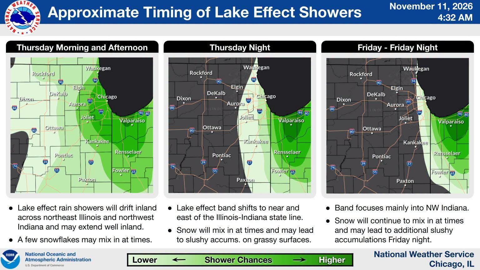
Then, temperatures will cool quite a bit on Thursday, which has a high of 48 degrees. On Thursday morning and afternoon, lake effect rain showers will drift inland, and a few snowflakes may mix in, according to the weather service.
Snow could also mix in at times on Thursday night, and could lead to "slushy accumulations on grassy surfaces," the weather service said.
Find out what's happening in Across Illinoisfor free with the latest updates from Patch.
On Friday and Friday night, the lake effect band will mostly focus on northwest Indiana, and snow could mix in again at times on Friday night for those areas.
Friday's high is just 45 degrees, with the warmest temperatures in Chicago and near the lakeshore.
Get more local news delivered straight to your inbox. Sign up for free Patch newsletters and alerts.