Weather
Snow Possible, Rain Likely For Chicago Area: NWS
A thunderstorm could happen Friday afternoon, with snow potentially making a return Saturday, according to the National Weather Service.

ILLINOIS — Get out your umbrella, and maybe even those snow boots, this weekend.
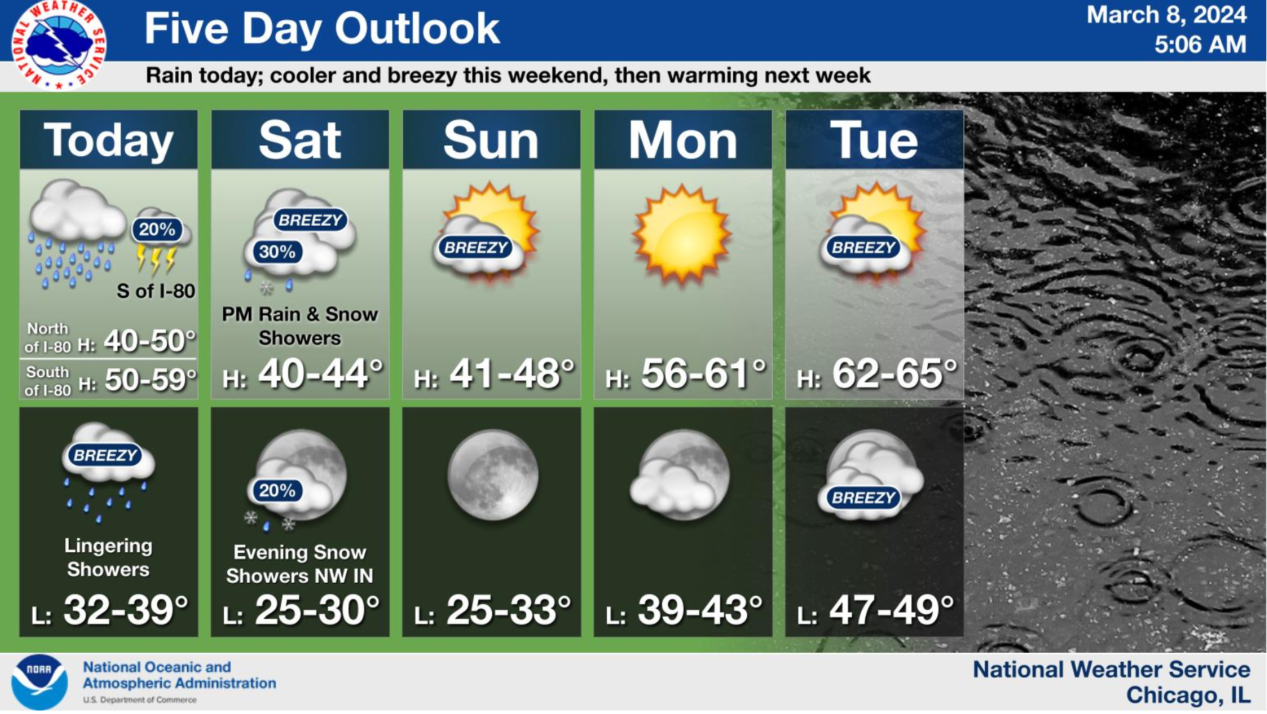
According to the National Weather Service, Friday will be "rainy and dreary" with potential of an isolated thunderstorm south of Interstate 80 in the afternoon. Temperatures are predicted to be between 40 and 50 degrees north of I-80 and between 50 and 59 degrees south of the interstate. Lingering showers will continue into Friday evening.
There is also a 30 percent chance of scattered rain and snow showers Saturday afternoon into the evening, with highs between 40 and 44 degrees during the day. Expect colder temperatures at night, especially in northwest Indiana, where snow showers are in the forecast.
Find out what's happening in Across Illinoisfor free with the latest updates from Patch.
Don't fret, though, if you're hoping Sunday's Daylight Savings Time means spring is finally here. Sunday will be breezy, but enjoy the extra light with temperatures warming up a little with highs of between 41 and 48.
Those temperatures will gradually warm more to start the week, according to NWS, with highs back in the upper 50s and lower 60s Monday.
Find out what's happening in Across Illinoisfor free with the latest updates from Patch.
Get more local news delivered straight to your inbox. Sign up for free Patch newsletters and alerts.