Weather
Snow Showers Monday Before Temps Hit 50s Mid-Week In Illinois
Temperatures will be in the 30s on Monday, the 50s by Wednesday, and back to the 40s on Friday.

ILLINOIS — Temperatures are expected to fluctuate quite a bit this week as we see highs in the 30s, 40s and 50s throughout the week, according to the National Weather Service.
Monday will be the coldest day of the week, and it will be blustery with snow showers. The weather service said the main time for "impactful snow showers" is from 8 a.m. to 2 p.m.
Tuesday will be slightly warmer with a high of 39 degrees, and no snow is expected, according to the weather service.
Find out what's happening in Across Illinoisfor free with the latest updates from Patch.
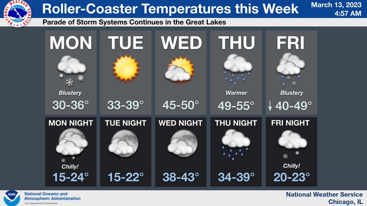
Wednesday will warm up, with highs of 50 degrees expected. It will be partly cloudy Wednesday, before rain moves into the area on Thursday, according to the weather service.
Thursday will be the warmest day of the week, with a high of 55 degrees.
Find out what's happening in Across Illinoisfor free with the latest updates from Patch.
AccuWeather said Thursday will be "breezy with periods of rain in the afternoon." The private forecaster called for .14 inches of rain.
Then, temperatures will cool off again on Friday, which has a high of 49 degrees. Friday will be blustery again, with rain and snow, the weather service said.
"A parade of storm systems" will then move through the Great Lakes during the weekend, according to the weather service Twitter. The forecast calls for a chance of snow on Saturday.
Get more local news delivered straight to your inbox. Sign up for free Patch newsletters and alerts.