Weather
Snow Totals Uncertain As Another Winter Storm Approaches Illinois
The weather service has issued a winter storm watch for McHenry and Lake counties.

ILLINOIS — Yet another winter storm is expected to hit the Chicago area, but the track of the storm and heaviest snowfall is still uncertain.
The storm will bring snow and rain to the area, starting Thursday afternoon through Friday morning, the National Weather Service said.
As of Wednesday afternoon, the weather service had only issued a winter storm watch for McHenry and Lake counties. The watch states that snow accumulations of 6 or more inches are possible for that area.
Find out what's happening in Across Illinoisfor free with the latest updates from Patch.
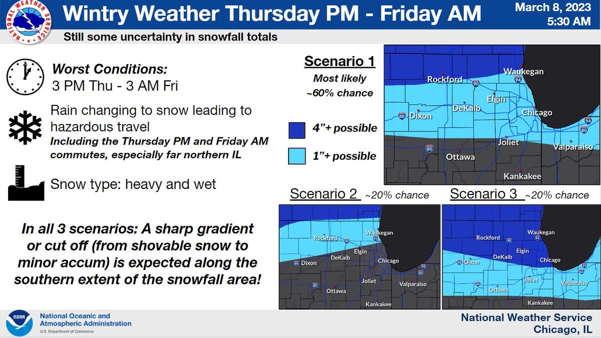
The most likely scenario is heavy snow falling near the Illinois-Wisconsin border, with lighter amounts south to Interstate 80, according to the weather service.
"...There is still time for the storm and associated snow threats to shift north or south," the weather service cautioned on its Twitter page.
Find out what's happening in Across Illinoisfor free with the latest updates from Patch.
The Thursday afternoon and Friday morning commutes could be impacted by the wintry weather, according to the weather service.
AccuWeather gave a slightly different forecast, giving a 52 percent probability for 3 to 6 inches of snow for the Joliet area. The private forecaster said there will be "a little morning snow" on Friday as the storm ends, and that "streets and sidewalks will be snow-packed and slippery."
Get more local news delivered straight to your inbox. Sign up for free Patch newsletters and alerts.