Weather
Stormy Monday Before Highs Near 60; Snow Could Close Out Week In IL
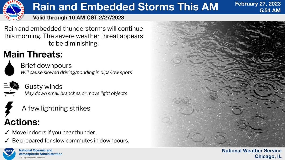
The main threats with Monday morning's storms are gusty winds, lightning strikes and brief downpours.

ILLINOIS — The work week will start off with a bang, as thunderstorms are expected Monday morning for the Chicago area. According to the National Weather Service, the severe weather threat is diminishing, but gusty winds will still be possible with Monday morning storms.
The main threats with the storms also include lightning strikes and brief downpours. The weather service said storm activity will diminish in the afternoon, and temps will be 57 degrees.
Tuesday should be dry, and also mild, with a high of 50 degrees. The weather service said there is a chance of showers on Tuesday night.
Find out what's happening in Across Illinoisfor free with the latest updates from Patch.
Wednesday will be the warmest day of the week, with a high of 60, and it should be partly cloudy during the day before showers are possible on Wednesday night, southeast of Interstate 55, according to the weather service.
Temps will get slightly colder again on Thursday, which has a high of 44 degrees. The weather service said the next weather system could arrive late Thursday, and there is a potential for accumulating snow to close out the week on Friday.
Find out what's happening in Across Illinoisfor free with the latest updates from Patch.
There is still uncertainty on the track of the storm on Friday, which has a forecasted high of 38 degrees.
AccuWeather said "intermittent wet snow" is possible for Joliet on Friday, and gave a prediction of 2.4 inches of snow. The private forecaster gave a 94 percent probability of precipitation.
Get more local news delivered straight to your inbox. Sign up for free Patch newsletters and alerts.