Weather
Tornadoes, Damaging Wind Possible As More Storms Hit IL
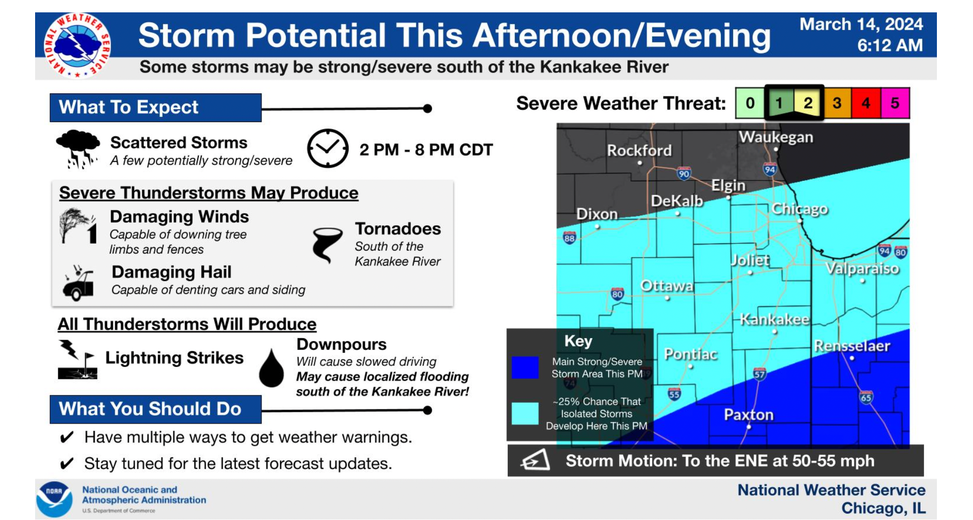
Some of Thursday's storms could be strong and severe, especially south of the Kankakee River, according to the National Weather Service.

ILLINOIS — Residents are advised to take caution with potentially severe weather, including tornadoes, in the forecast through Thursday evening. Scattered storms are predicted between 2 p.m. and 8 p.m., according to the National Weather Service.
In addition to tornadoes, the strong thunderstorms may produce damaging wind and hail. All thunderstorms will produce lightning strikes and downpours, with flooding possible south of the Kankakee River.
A ground stop was lifted at O'Hare International Airport and Midway as the severe storms were approaching the Chicago area Thursday morning, reports WBBM-TV. A ground delay remains in place with nearly 250 flights at O'Hare delayed, along with more than 30 flights at Midway.
Find out what's happening in Across Illinoisfor free with the latest updates from Patch.
RELATED: Ground Stop Issued At Chicago's O'Hare, Midway Airports Amid Thunderstorms
After the round of storms end Thursday morning, NWS said additional storms may develop this afternoon.
Find out what's happening in Across Illinoisfor free with the latest updates from Patch.
Temperatures are predicted to be between 47 and 55 degrees north of Interstate 88, and 57 to 68 degrees south of I-88. They will drop to between 34 and 44 degrees Thursday night.
NWS said after Thursday's rain and storms, drier conditions are expected into this weekend.
High temperatures for Friday are predicted to be between 45 and 55 degrees, with a rise Saturday to between 55 and 60. Cooler temperatures will also return to the area on Sunday, along with windy and breezy conditions.
Get more local news delivered straight to your inbox. Sign up for free Patch newsletters and alerts.