Weather
Tornadoes, Damaging Winds; Flash Flood Watch Issued For Chicago Area
Showers and storms are expected Monday, from mid-morning into the evening.

ILLINOIS — The work week will start off stormy and wet, before nicer weather moves in toward the middle of the week, according to the National Weather Service.
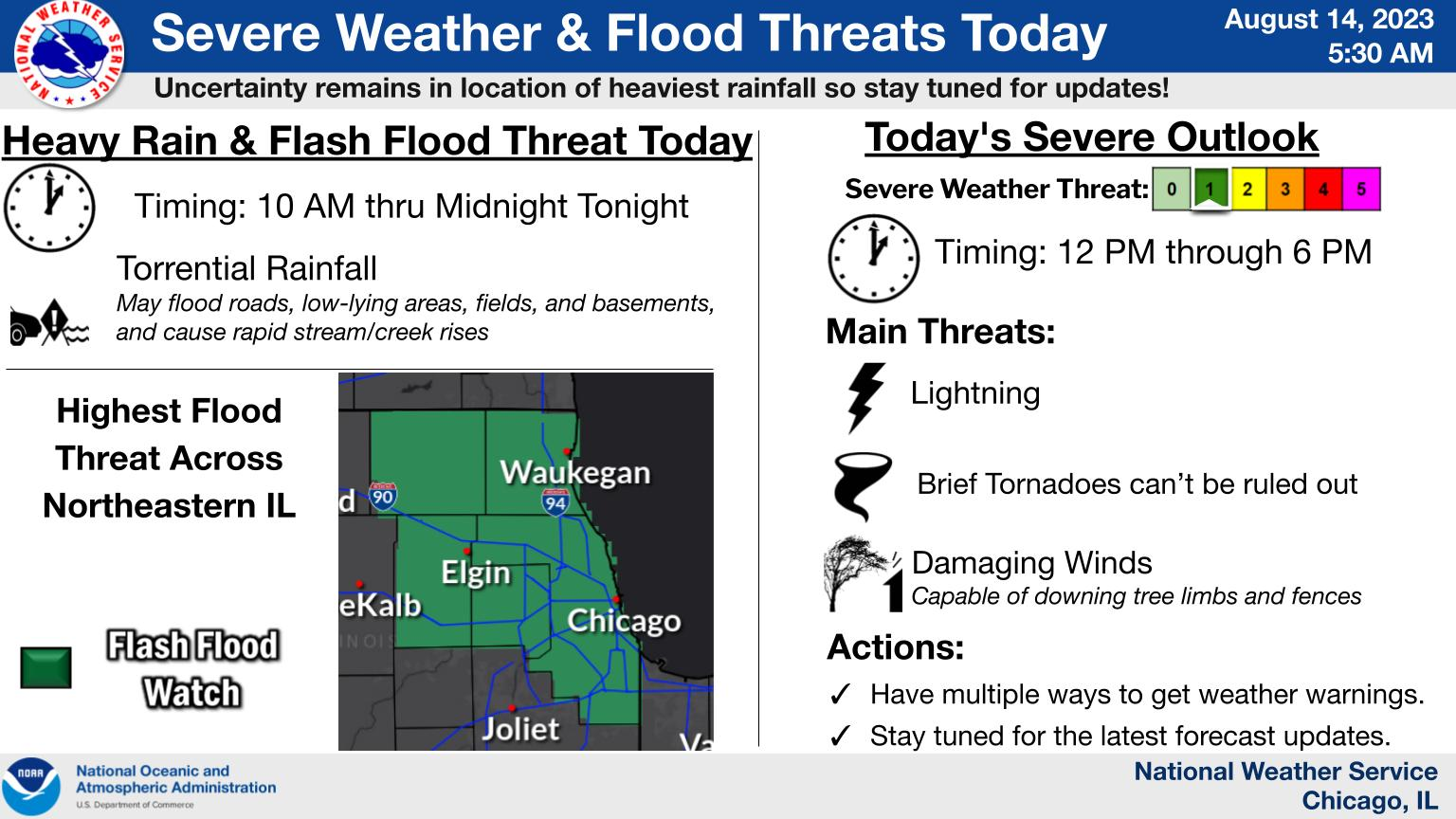
A flash flood watch is in effect for some of the Chicago area, including McHenry, Lake, DuPage and Cook counties, until Monday evening. The weather service said excessive rainfall could cause flash flooding.
Showers and storms are expected Monday, from mid-morning into the evening, according to the weather service. There is a small threat of severe storms, which could produce isolated tornadoes and damaging winds.
Find out what's happening in Across Illinoisfor free with the latest updates from Patch.
Heavy rain could hit between 10 a.m. and midnight, with torrential rainfall that could flood roads, low-lying areas, fields and basements. The risk for severe storms is between noon and 6 p.m., the National Weather Service said.
After storms move through, winds could result in large waves and hazardous swimming conditions for Lake Michigan beaches on Monday afternoon and night, the weather service said.
Find out what's happening in Across Illinoisfor free with the latest updates from Patch.
Tuesday and Wednesday look to be dry and sunny, with a high of 77 and a high of 82, respectively. A chance of rain is possible on Thursday, which has a high of 83 degrees.
Friday will finish out the week dry and sunny again, with a high of 83, according to the weather service.
Get more local news delivered straight to your inbox. Sign up for free Patch newsletters and alerts.