Weather
Snow, Storms Possible After Chicago Area Hits Record High Temp
Snow is possible on Sunday night, and Monday will be chilly with a high of 48 degrees.

ILLINOIS — After Chicago set a new record high of 83 degrees at O'Hare Thursday, warm temperatures will continue on Friday and Saturday before a cold front comes in, bringing the potential for storms before snow could hit on Sunday and Monday.
Friday's forecasted high is 82 degrees, and Saturday a high of 81. Both days will be mostly sunny, according to the National Weather Service.
Scattered thunderstorms are also expected on Saturday night, and a few storms could have severe hail and wind gusts over 45 mph, the weather service said.
Find out what's happening in Across Illinoisfor free with the latest updates from Patch.
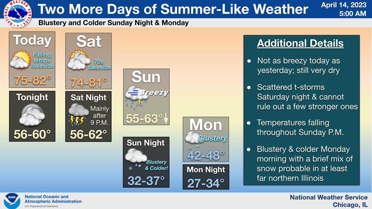
Sunday will have a high of 63 degrees, and it will be breezy with a possibility for storms again, according to the weather service. Temperatures will fall on Sunday afternoon, and by Sunday night, it will be blustery with a high of 37 degrees.
AccuWeather said rain will mix with snow on Sunday night, "with little or no accumulation." The private forecaster gave a prediction of .21 inches of rain and .2 inches of snow.
Find out what's happening in Across Illinoisfor free with the latest updates from Patch.
Monday has a high of 48, and there is again a chance of rain and snow in the morning, according to the weather service. "Blustery and much colder conditions will prevail Monday," the National Weather Service said.
Temperatures will begin to rise again after Monday; Tuesday has a high of 56, Wednesday a high of 70, and Thursday a high of 72.
Thursday's record high of 83 degrees beats the previous record high for April 13 of 82 degrees, set in 1887 and tied in 1941.
Get more local news delivered straight to your inbox. Sign up for free Patch newsletters and alerts.