Weather
First Measurable Snow Possible Tuesday, Storms Sunday For IL
Wet snow is possible Tuesday morning, mainly north of I-80. Slippery roads are possible.

ILLINOIS — "Messy" weather is possible Tuesday, as there is a chance for the first measurable snow of the season, according to the National Weather Service.
But first, a burst of snow/sleet is possible Sunday evening near and north of Interstate 90 in northern Illinois, according to the weather service. There will be little to no impacts, and any slush will be on grassy surfaces. There could also be occasional downpours and even scattered thunderstorms on Sunday night, the weather service said.
Patchy fog and light rain will start the day on Monday, which has a high of 58 degrees, according to the weather service.
Find out what's happening in Chicagofor free with the latest updates from Patch.
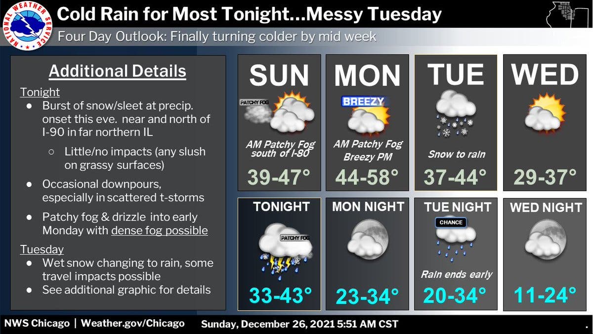
Tuesday will have a high of 44 degrees, and a period of accumulating snow is possible in the morning and early afternoon, mainly north of Interstate 80, according to the weather service.
Wet snow will change over to rain by mid-afternoon, the weather service said. Slippery roads are possible due to the snow and slush.
Find out what's happening in Chicagofor free with the latest updates from Patch.
Temperatures will start to turn colder on Wednesday, which has a high of 37 degrees, and should be partly sunny, according to the weather service.
Thursday will also be mostly sunny with a high near 32, followed by a sunny Friday with a high near 36 degrees, according to the weather service forecast. There is a slight chance of snow on Friday night.
Get more local news delivered straight to your inbox. Sign up for free Patch newsletters and alerts.