Weather
3 Inches Of Snow Possible On Last Day Of Bitter Cold
Accumulating snow of possibly a few inches is likely Thursday from mid-afternoon through evening.


The bitter cold temperatures will soon move out of Illinois, but first, we will get up to 3 inches of snow on Thursday. The National Weather Service said accumulating snow of possibly a few inches is likely Thursday from mid-afternoon through evening.
Most of the area will see 2 to 3 inches of snow, while the far northern suburbs will see 1 to 2 inches.
The wind chill warning that is in effect for most of the area will end at 12 p.m. Thursday. However, there will be wind chills as low as 30 to 50 below zero through Thursday morning. The NWS said Thursday would most likely begin with record-breaking cold temperatures.
Find out what's happening in Lemontfor free with the latest updates from Patch.
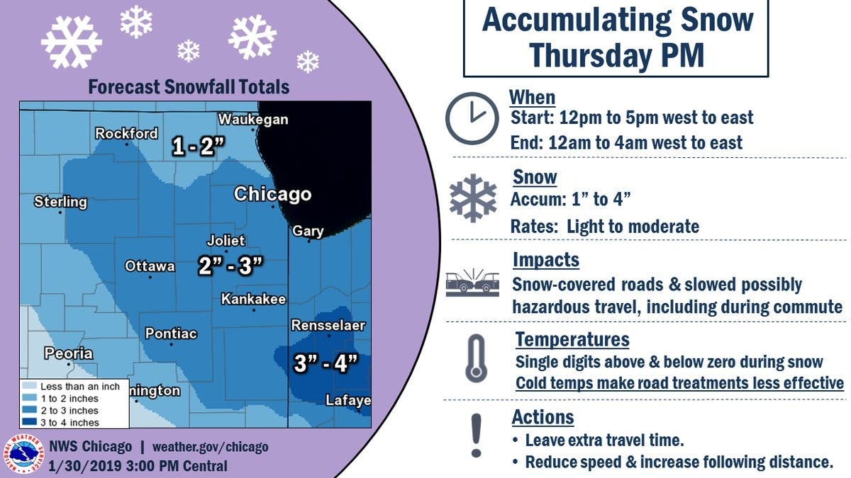
For those who will be on the roads Thursday evening, the commute could be impacted. The NWS said to allow extra travel time, as roads could be snow-covered.
The dangerously cold wind chills could cause frostbite on exposed skin in as little as 5 to 10
minutes, according to the NWS. Wear layers and cover any exposed skin.
Find out what's happening in Lemontfor free with the latest updates from Patch.
Starting Friday and into the weekend, the Chicago area will see a major warmup, with temperatures reaching the mid-40s by Sunday and the 50s — a temperature swing of nearly 80 degrees, according to WGN — by Monday.
Image via Shutterstock.
Get more local news delivered straight to your inbox. Sign up for free Patch newsletters and alerts.

