Weather
Heavy Snowfall, 40 MPH Gusts, Below Zero Windchill: Winter Storm
The latest: New snowfall predictions, bone-chilling temperatures and potentially hazardous travel.

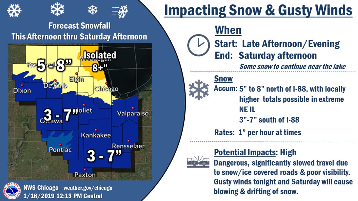
A winter storm warning in effect for the entire Chicago area had been extended until 6 p.m. Saturday, with new snowfall products of 5 to 8 inches north of I-88 and 3 to 7 inches south of I-88, with heavy rates of snowfall at times making for low visibility and potentially hazardous travel. Wind gusts of up to 40 mph could make for dangerous travel with drifting and blowing snow.
If you must travel, the NWS recommends keeping an extra flashlight, food and water in your vehicle in case of an emergency.
Wild Winter Weather: What The Fractured Polar Vortex Means For IL
Find out what's happening in Lemontfor free with the latest updates from Patch.
Those snowfall totals are anticipated only through Saturday afternoon and do not account for lake-effect snow, which is expected to start Saturday evening and continue through Sunday. Lake-effect snow could add another 2 to 6 inches in some areas, beginning Saturday night and continuing through early Saturday afternoon.
Saturday could also bring bone-chilling temperatures. Wind chills as low as -15 are possible Saturday night. NWS says hypothermia and frostbite are possible in just one hour for those who are not properly dressed for the cold.
Find out what's happening in Lemontfor free with the latest updates from Patch.
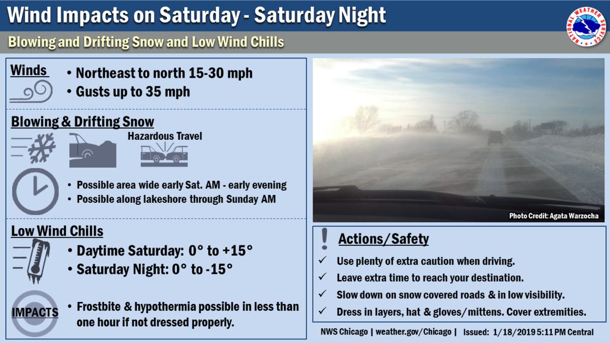
Image via Shutterstock.
Get more local news delivered straight to your inbox. Sign up for free Patch newsletters and alerts.

