Weather
Hail, 60 MPH Winds Possible As Strong Storms Move Into The Area
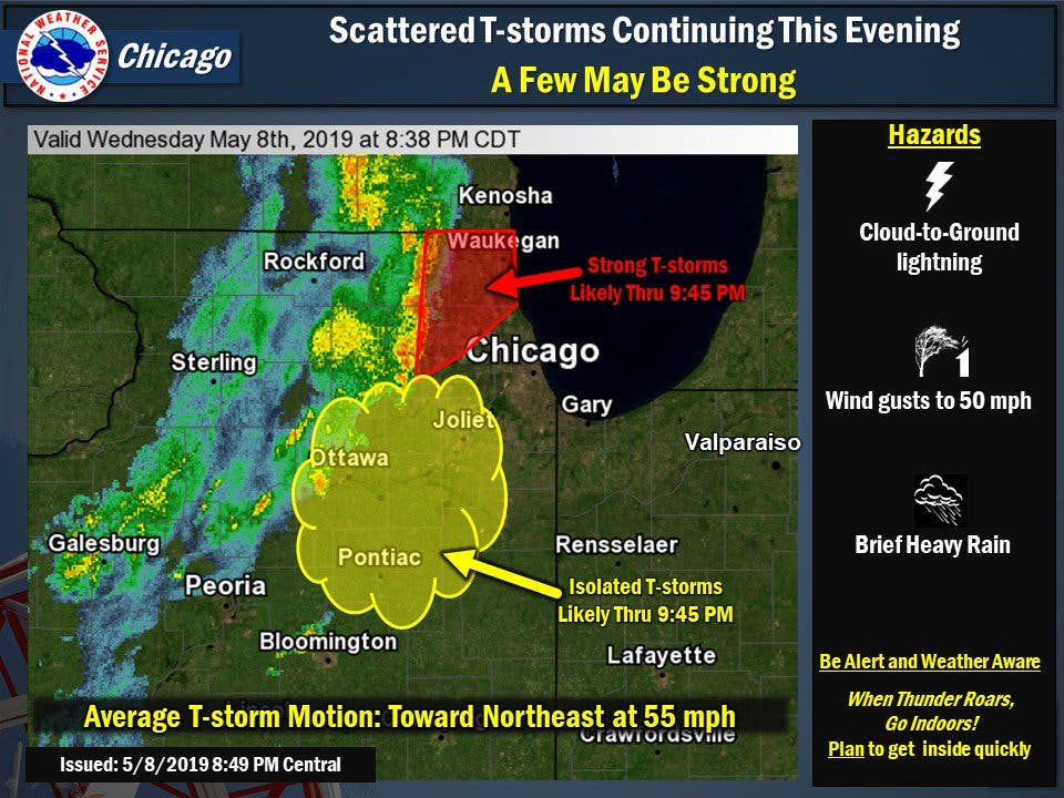
Strong thunderstorms are likely through 9:45 p.m. in the north suburbs.


ILLINOIS — Thunderstorms are moving eastward across Illinois this evening, and strong storms are possible. According to the National Weather Service, there is an elevated thunderstorm risk as well as a limited risk for hail, damaging winds up to 60 mph and flooding on Wednesday night.
The NWS said an area of showers and thunderstorms will move eastward across northern Illinois through the evening hours. Some storms could become strong with the main threat from strong gusty winds.
Strong thunderstorms are likely through 9:45 p.m. in the north suburbs. The south suburbs could see some isolated thunderstorms through 9:45 p.m., the NWS said.
Find out what's happening in Lemontfor free with the latest updates from Patch.
The threat for strong storms will decrease through the evening hours, but gusty winds could still be possible.
The NWS previously issued a tornado warning near La Salle that was valid until 8:30 p.m. In the warning, the NWS said there was a severe thunderstorm capable of producing a tornado located near McNabb, or 13 miles southeast of Hennepin, moving northeast at 55 mph.
Find out what's happening in Lemontfor free with the latest updates from Patch.
Thunderstorms could also produce locally-heavy rainfall, which could lead to some renewed river rises and additional flooding, the NWS said.
Get more local news delivered straight to your inbox. Sign up for free Patch newsletters and alerts.