Weather
Light Snow Possible Before Rain, Snow Mix: IL Weather
It will be colder Saturday with a high of 39 degrees, before temperatures warm slightly again on Sunday, which has a high of 46.


ILLINOIS — Although spring is almost officially here, Illinoisans could see a bit of snow this weekend. The National Weather Service said there is a chance of snow Saturday, which could then turn to a mix of rain and snow, especially south of I-88.
It will be colder Saturday with a high of 39 degrees, before temperatures warm slightly again on Sunday, which has a high of 46. The weather service said Sunday should be dry and mostly sunny.
Monday looks to be even milder and temps could rise above 50 degrees.
Find out what's happening in Lemontfor free with the latest updates from Patch.
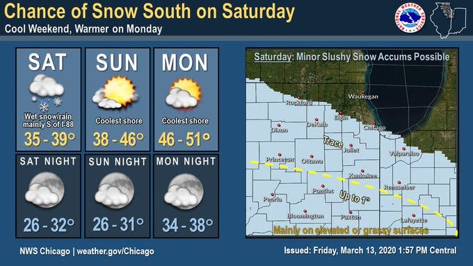
Here is a more detailed look at the weather this weekend, with a forecast from the National Weather Service:
- FRIDAY NIGHT: Increasing clouds, with a low around 32. West northwest wind 5 to 10 mph becoming north northeast after midnight. Winds could gust as high as 15 mph.
- SATURDAY: A slight chance of snow before 10 a.m., then a chance of rain and snow. Cloudy, with a high near 37. East northeast wind 5 to 10 mph, with gusts as high as 20 mph. Chance of precipitation is 30 percent.
- SATURDAY NIGHT: A slight chance of rain and snow before 7 p.m. Cloudy, then gradually becoming partly cloudy, with a low around 29. North northeast wind 10 to 15 mph, with gusts as high as 20 mph. Chance of precipitation is 10 percent.
- SUNDAY: Mostly sunny, with a high near 43. East northeast wind around 10 mph, with gusts as high as 15 mph.
- SUNDAY NIGHT: Mostly clear, with a low around 29.
Find out what's happening in Lemontfor free with the latest updates from Patch.
Get more local news delivered straight to your inbox. Sign up for free Patch newsletters and alerts.