Weather
Tornado Watch Canceled As Storms Move Out Of Chicago Area
Thunderstorms expected on Thursday with an associated limited tornado risk for northeast Illinois and northwest Indiana.

Thunderstorms, rain and wind are expected across the area as a "bomb cyclone" approaches Illinois. A deep low pressure will lift through the upper Midwest on Thursday, causing bombogenesis or a "bomb cyclone." Scattered severe thunderstorms are expected ahead of a strong cold front. The NWS said there is a risk for tornadoes, damaging winds and hail, along with intense thunderstorms. The highest threat is in the Chicago metro area, along and east of I-55.
The severe risk will quickly end with a cold front passage from 1 p.m. to 4 p.m., from west to east.
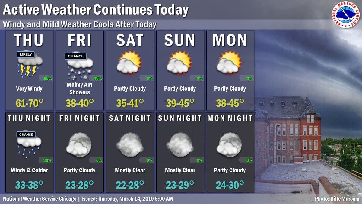
It will also be very windy outside of any thunderstorms, the NWS said. Winds will gust between 45 to 55 mph on Thursday afternoon through early evening. There is a wind advisory in effect until 10 p.m. for northeast Illinois. Impacts could include difficult travel and scattered minor tree damage.
Find out what's happening in Lemontfor free with the latest updates from Patch.
Get more local news delivered straight to your inbox. Sign up for free Patch newsletters and alerts.

