Weather
Tornado Watch Issued For Grundy, Kankakee Counties
A tornado watch has been issued far south of Chicago as severe storms move into the area.


ILLINOIS — A tornado watch has been issued far south of Chicago for Ford, Grundy, Iroquois, Kankakee and Livingston counties until 9 p.m. Wednesday.
Severe weather is possible for the Chicago area on Wednesday evening as storms move into the area. According to the National Weather Service, scattered thunderstorms are expected to develop, and some storms could be strong to severe.
The primary threat with these storms will be damaging wind and large hail, the weather service said. There is also a low tornado threat in the Chicago area.
Find out what's happening in Lemontfor free with the latest updates from Patch.
Storms may also produce very heavy rainfall, which could lead to localized flooding. According to the weather service, the greatest flash flooding risk is south and east of I-55.
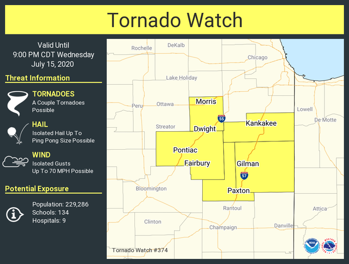
Severe weather is possible between 4 and 8 p.m., with the greatest severe risk south of I-80, according to the weather service.
Find out what's happening in Lemontfor free with the latest updates from Patch.
The weather service said there is also a limited thunderstorm risk expected Friday, Saturday, Sunday and Monday. Dangerous heat will move into the area, with heat index values near 105 degrees likely on Saturday and Sunday.
Get more local news delivered straight to your inbox. Sign up for free Patch newsletters and alerts.