Weather
Severe Thunderstorm Watch Issued For Chicago Area
A severe thunderstorm watch has been issued for most of northern Illinois until 3 a.m. Friday.

Severe weather will continue into Thursday evening, and a severe thunderstorm watch has been issued for most of northern Illinois until 3 a.m. Friday. The watch includes Bureau, Ford, Iroquois, La Salle, Marshall, Putnam, Whiteside, Carroll, Grundy, Kankakee, Lee, Mercer, Rock Island, Will, De Kalb, Henry, Kendall, Livingston, Ogle and Stark counties.
The National Weather Service said there is an elevated thunderstorm risk with an associated elevated hail risk and elevated damaging wind risk on Thursday evening.
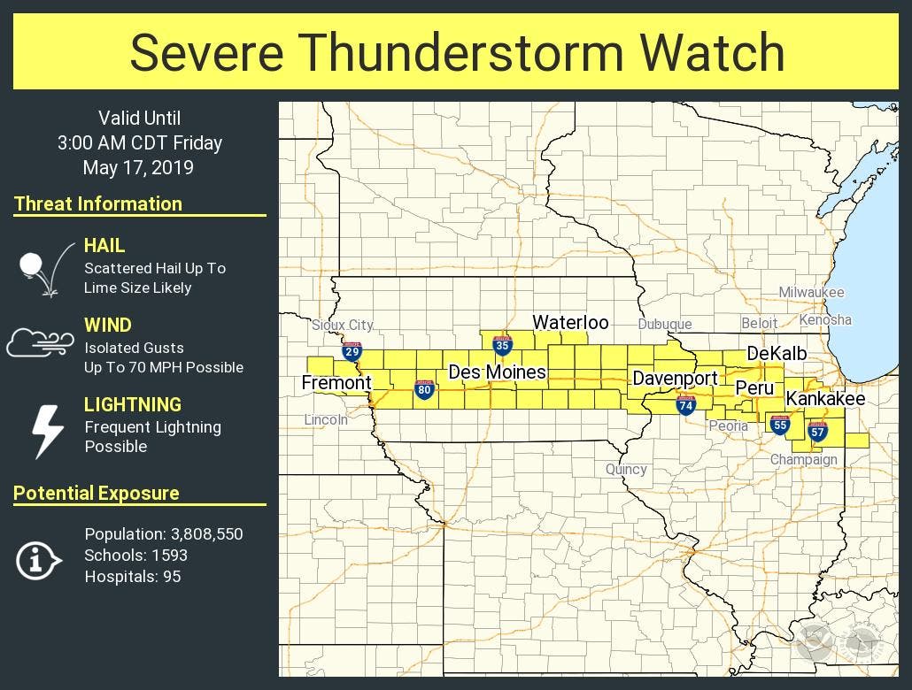
A conditional severe thunderstorm threat remains for mid to late evening on Thursday and into the early overnight hours. The NWS said the atmosphere is stable in wake of earlier storms, but should quickly recover again tonight. Initial storms would be capable of strong winds and large hail.
Find out what's happening in Lemontfor free with the latest updates from Patch.
The threat may shift to very heavy rainfall and localized flooding potential overnight, according to the NWS.
Severe thunderstorms were reported over much of the Chicago area on Thursday afternoon, and several power outages were reported in several south suburban towns.
Find out what's happening in Lemontfor free with the latest updates from Patch.
Taken from the Snadwich High School Peking lot!! #ILwx #Tornado @NWSChicago pic.twitter.com/wPqJCxembS
— Jake Smith (@jwsmith_056) May 16, 2019
Thunderstorms will also continue Friday morning, with the strongest, potentially severe storms, along the I-80 corridor. The NWS said periods of thunderstorms are also expected through the weekend and into next week, and there may be additional chances for severe storms.
Get more local news delivered straight to your inbox. Sign up for free Patch newsletters and alerts.

