
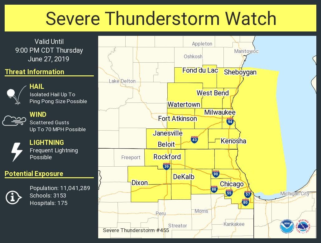
ILLINOIS — A severe thunderstorm watch has been issued in Boone, DuPage, Lee, Winnebago, Cook, Kane, McHenry, DeKalb, Lake and Ogle counties until 9 p.m. The National Weather Service said there is a limited tornado risk, limited hail risk and elevated damaging wind risk.
Isolated storms are possible Thursday afternoon along a lake breeze in northeast Illinois and northwest Indiana. The NWS said the storms are coming from Iowa and are expected to intensify this afternoon, with strong to severe storms appearing possible. The highest threat of storms will be for areas north of I-80.
The main threats for these storms are ping pong size hail, gusts up to 70 mph and frequent lightning. Additional storms are also possible late Thursday night into early Friday, the NWS said.
Find out what's happening in Lemontfor free with the latest updates from Patch.
Get more local news delivered straight to your inbox. Sign up for free Patch newsletters and alerts.

