Weather
Severe Thunderstorm Watch Issued For Northern IL
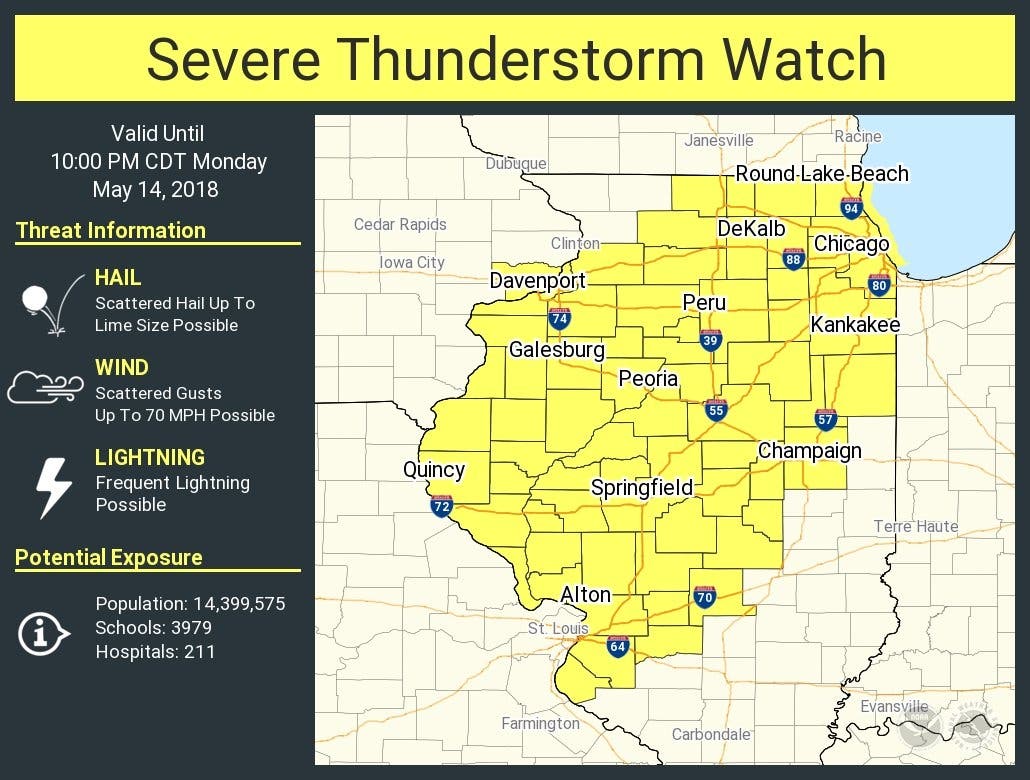
Storm threats include hail, damaging winds and frequent lightning.


Severe storms are once again possible Monday afternoon and evening. The National Weather Service has issued a severe thunderstorm watch which is in effect until 10 p.m. for Grundy, Lee, Kane, McHenry, Warren, Winnebago, Cook, DuPage, DeKalb, Iroquois, Kendall, Kane, Kankakee, Lake, La Salle and Will counties.
According to the NWS, threats with this storm include hail, winds up to 70 mph and frequent lightning. Scattered thunderstorms are expected throughout the area, and storms will develop along and west of I-39 in northern Illinois.
Storms will move east into northern Illinois and eventually northwest Indiana, according to the NWS.
Find out what's happening in Lemontfor free with the latest updates from Patch.
Storms are also possible across the area on Tuesday. Here is a look at your upcoming forecast:
- MONDAY AFTERNOON: A 30 percent chance of showers and thunderstorms after 4 p.m. Mostly cloudy, with a high near 82. Southwest wind around 10 mph, with gusts as high as 15 mph.
- MONDAY NIGHT: Showers and thunderstorms likely, mainly after 1am. Cloudy, with a low around 60. South southeast wind around 5 mph becoming west after midnight. Chance of precipitation is 70%. New rainfall amounts between a half and three quarters of an inch possible.
- TUESDAY: Showers and thunderstorms likely, mainly before 2 p.m. Mostly cloudy, with a high near 73. Northwest wind 5 to 15 mph becoming north northeast in the afternoon. Chance of precipitation is 70%. New rainfall amounts between a quarter and half of an inch possible.
- TUESDAY NIGHT: A 20 percent chance of showers and thunderstorms before 8 p.m. Mostly cloudy, with a low around 52. North northeast wind 5 to 15 mph.
Find out what's happening in Lemontfor free with the latest updates from Patch.
Get more local news delivered straight to your inbox. Sign up for free Patch newsletters and alerts.

