Weather
Storms Then A Big Weekend Weather Shift For IL
This weekend will be pleasant and sunny on both Saturday and Sunday.


Another nice, spring weekend is in store for the Chicago area. Although some rain or storms are possible Friday evening, Saturday and Sunday should both be pleasant and dry.
According to the National Weather Service, rain and thunderstorms are possible before 8 p.m. Friday, before turning cloudy for the rest of the night. Saturday will be slightly cooler with a high of 55 degrees, and you will see some gusts up to 25 mph during the day.
The warm-up will start Sunday, which has a high of 63 degrees. Both days this weekend should remain dry, and the heat will begin after the weekend. Get ready for the start of the work week, as we could see a high of 75 degrees on Monday and a high of 80 degrees on Tuesday.
Find out what's happening in Lemontfor free with the latest updates from Patch.
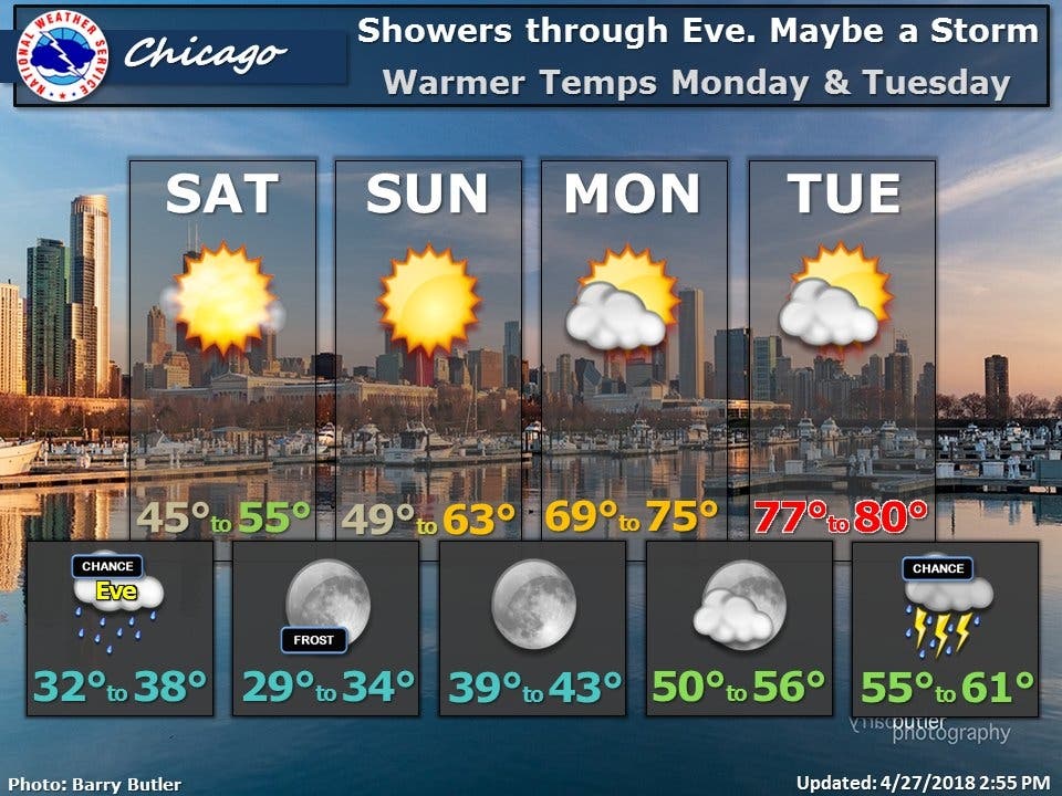
Here is a more detailed look at the weather:
- FRIDAY NIGHT: Showers and thunderstorms likely before 8 p.m., then a chance of showers between 8 p.m. and 9 p.m. Cloudy, then gradually becoming partly cloudy, with a low around 35. East northeast wind around 10 mph becoming north after midnight. Winds could gust as high as 15 mph. Chance of precipitation is 60%. New precipitation amounts of less than a tenth of an inch, except higher amounts possible in thunderstorms.
- SATURDAY: Mostly sunny, with a high near 53. North northeast wind 10 to 15 mph, with gusts as high as 25 mph
- SATURDAY NIGHT: Areas of frost after 3 a.m. Otherwise, clear, with a low around 32. North northeast wind 5 to 10 mph.
- SUNDAY: Areas of frost before 7 a.m. Otherwise, sunny, with a high near 59. North northwest wind around 5 mph becoming south southwest in the afternoon.
- SUNDAY NIGHT: Clear, with a low around 41.
- MONDAY: Sunny, with a high near 72.
Find out what's happening in Lemontfor free with the latest updates from Patch.
Get more local news delivered straight to your inbox. Sign up for free Patch newsletters and alerts.

