Weather
Tornado Warning For Kane, Kendall Counties
The warning expired at 12:15 a.m. but severe weather was expected through the night.


ILLINOIS — A tornado warning was issued just before midnight for southwestern Kane, northwestern Kendall and southeastern DeKalb counties, effective until 12:15 a.m. Friday, the National Weather Service said. A severe storm warning is in effect until 12:30 a.m. for Kane, Kendall, DeKalb and LaSalle counties, and severe weather was possible through the night.
A severe thunderstorm watch has also been issued through 1 a.m. Friday for Will, Grundy, Kankakee and Kendall counties.
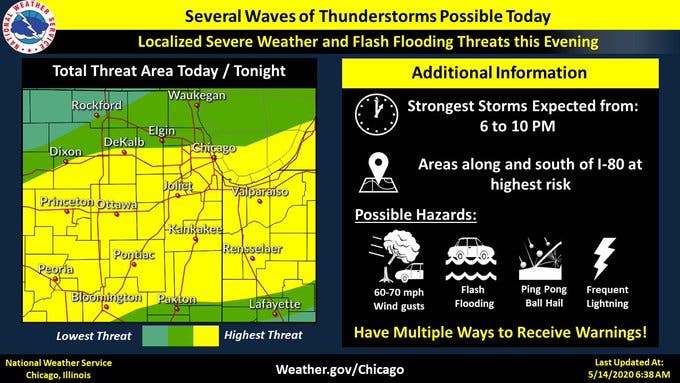
The strong storms could bring 60-70 mph wind gusts, flash flooding, ping pong ball-sized hail and frequent lightning, according to the weather service.
Find out what's happening in Lemontfor free with the latest updates from Patch.
Flash flood watches have been issued in Cook, DeKalb, DuPage, Will, Grundy, Kane, Kankakee and Kendall counties through Friday morning. The thunderstorms expected Thursday night could result in localized rainfall amounts of three inches or more, the weather service said.
With the heavy rain Thursday morning and the expected rain tonight, the weather service issued a flood warning for the east branch DuPage River in Bolingbrook. Minor flooding is forecast, the weather service said.
Find out what's happening in Lemontfor free with the latest updates from Patch.
Get more local news delivered straight to your inbox. Sign up for free Patch newsletters and alerts.