Weather
Tornado Watch, Flash Flood Watch Issued As Storms Approach Area
Severe thunderstorms are possible Friday night for most of the Chicago area.

ILLINOIS — Most of the Chicago area has a significant thunderstorm risk for Friday late afternoon and evening. The National Weather Service said there is also an elevated hail risk, elevated damaging wind risk, tornado risk and significant flash flood risk. A tornado watch is in effect until midnight for counties including Grundy, La Salle, Lee, Livingston, Ogle and Winnebago.
A flash flood watch has been issued Cook, Boone, DeKalb, DuPage, Grundy, Kane, Kendall, La Salle, Lake, Lee, McHenry, Ogle, Will and Winnebago counties through Saturday morning.
After some storms early Friday morning, thunderstorms could redevelop late Friday afternoon and night, especially from 6 p.m. to 2 a.m. The NWS said some of these storms could be severe with large hail and damaging winds as the primary threats. There is also a low tornado risk as well.
Find out what's happening in Lemontfor free with the latest updates from Patch.
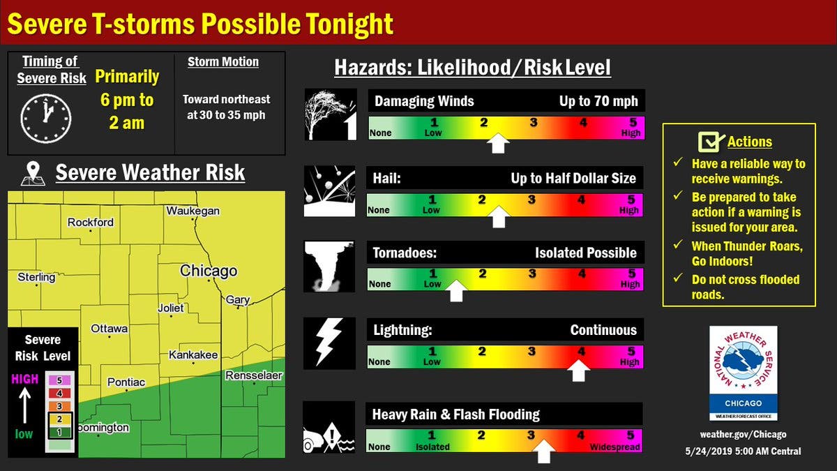
These storms could also produce torrential rainfall which cause cause localized flash flooding on Friday night. The flash flood watch states that storms are capable of producing rates of 1 to 2 inches of rain per hour.
Get more local news delivered straight to your inbox. Sign up for free Patch newsletters and alerts.

