Weather
Tornadoes Possible, Severe Thunderstorm Watch Issued
Storms will develop across the area during the early to mid-afternoon hours ahead of a cold front.

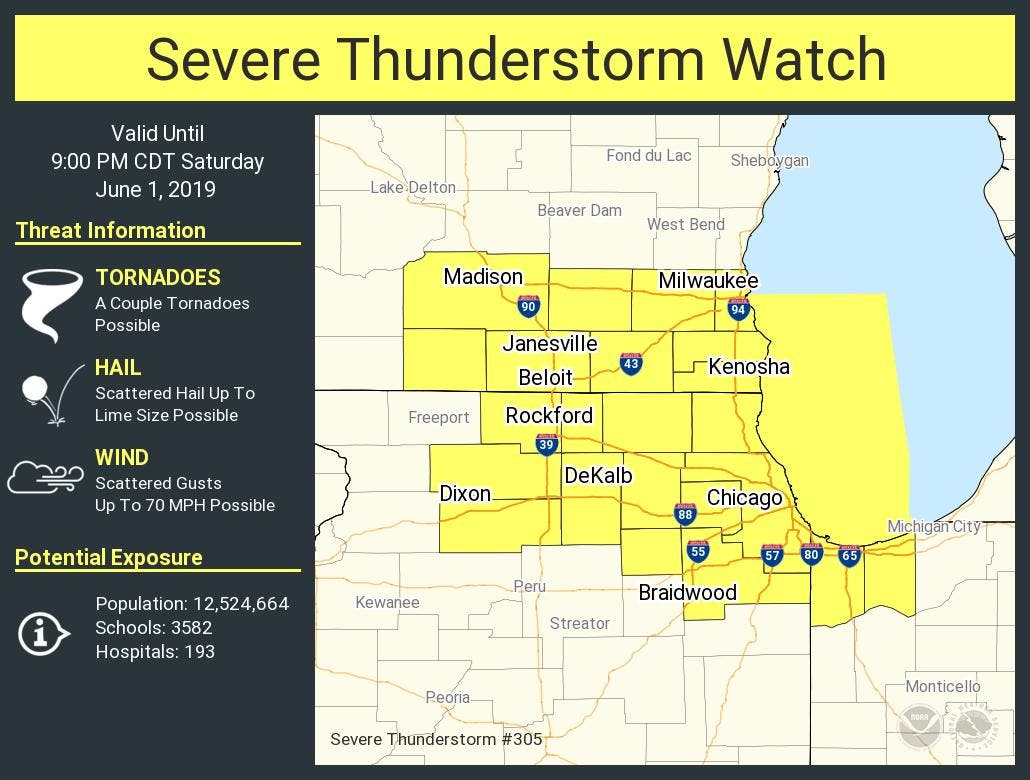
ILLINOIS — A severe thunderstorm watch has been issued for several counties in northern Illinois until 9 p.m. Saturday. Counties under the watch include: Boone, Cook, DeKalb, DuPage, Kane, Kendall, Lake, Lee, McHenry, Ogle, Will and Winnebago. The National Weather Service said there is a significant thunderstorm risk, as well as an elevated hail risk up to golf ball size, elevated damaging wind risk up to 70 mph, limited tornado risk and limited flooding risk.
The NWS said storms will develop across the area during the early to mid-afternoon hours ahead of a cold front. These storms have the potential to become strong to severe. The threats for the storms include large hail and damaging winds.
The tornado threat is low, but can't be ruled out, especially near I-90, the NWS said.
Find out what's happening in Lemontfor free with the latest updates from Patch.
The NWS said storms may be slow-moving and could produce locally heavy rainfall. Since the ground is already saturated, this could lead to localized instances of flash flooding.
Get more local news delivered straight to your inbox. Sign up for free Patch newsletters and alerts.

