Weather
Wind Chill Advisory Returns, Bitter Cold Continues Into Weekend
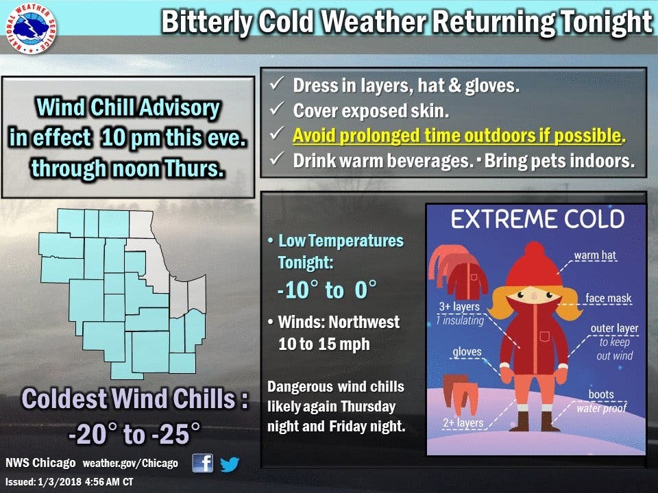
The wind chill advisory begins Wednesday evening and ends Thursday at noon.

The bitterly cold temperatures seem to be sticking around for a few more days in Illinois. The National Weather Service has issued a wind chill advisory starting at 10 p.m. Wednesday and ending at 12 p.m. Thursday for Winnebago, Boone, McHenry, Ogle, Lee, DeKalb, Kane, DuPage, Kendall, Grundy, La Salle, Will and Kankakee counties.
According to the NWS, very cold wind chills are expected from -20 to -30 degrees. The cold wind chills will cause frostbite in as little as 30 minutes to exposed skin.
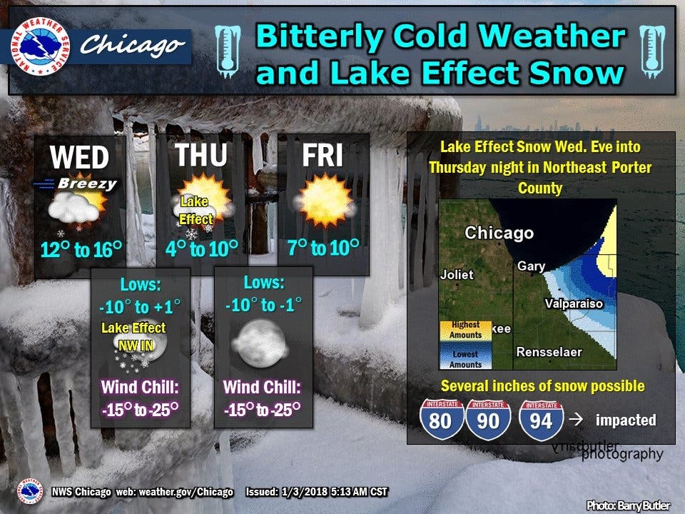
Here's a more detailed look at the next few days:
Find out what's happening in Lemontfor free with the latest updates from Patch.
- WEDNESDAY: Partly sunny, with a high near 16. Wind chill values as low as -5. Northwest wind 10 to 15 mph, with gusts as high as 20 mph.
- WEDNESDAY NIGHT: Mostly clear, with a low around -3. Wind chill values as low as -18. Northwest wind around 10 mph, with gusts as high as 15 mph.
- THURSDAY: Sunny and cold, with a high near 8. Wind chill values as low as -19. Northwest wind around 10 mph, with gusts as high as 15 mph.
- THURSDAY NIGHT: Mostly clear, with a low around -5. Wind chill values as low as -18. Northwest wind 5 to 10 mph.
- FRIDAY: Sunny and cold, with a high near 9. Northwest wind 5 to 10 mph.
- FRIDAY NIGHT: Mostly clear, with a low around -6.
- SATURDAY: Mostly sunny, with a high near 13.
- SATURDAY NIGHT: Mostly cloudy, with a low around 9.
Get more local news delivered straight to your inbox. Sign up for free Patch newsletters and alerts.

