Weather
IL Weather: Wintry Temps, Snow In The Forecast
Cold temperatures and possibly some snow are in the forecast for this weekend.


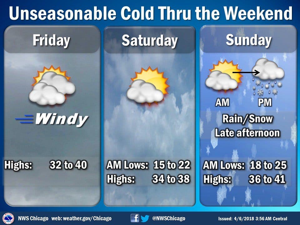
Winter is still clinging on in Illinois this weekend. Unseasonably cold temperatures and a chance of snow is possible this weekend. According to the National Weather Service, another storm system will bring accumulating snow to the region late Sunday into early Monday. A few inches are possible, mainly on grass, but there could be some impacts on the roads.
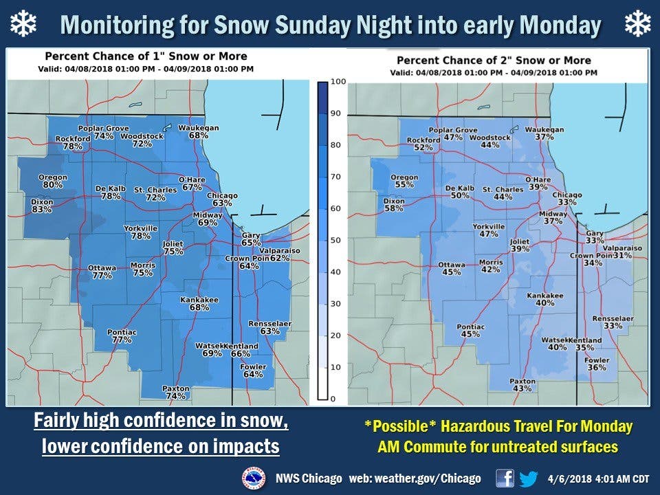
It seems that most of the area will get an inch of snow, but there is less confidence for higher amounts. Temperatures will also remain in the 30s on the both Saturday and Sunday. According to the NWS, the high for Saturday is 38 degrees, while Sunday has a high of 41.
While colder temperatures will stick around for the beginning of the work week, the spring-like temperatures are finally in sight starting on Wednesday next week.
Find out what's happening in Lemontfor free with the latest updates from Patch.
Here's a more detailed look at your weekend forecast:
- FRIDAY NIGHT: Partly cloudy in the evening then clearing. Lows 17 to 21. Northwest winds 10 to 20 mph.
- SATURDAY: Mostly sunny. Highs in the mid 30s. Northwest winds 10 to 15 mph.
- SATURDAY NIGHT: Clear. Lows around 20 in the suburbs...but in the mid 20s downtown. Northwest winds 5 to 10 mph.
- SUNDAY: Partly sunny. Highs in the upper 30s. Northeast winds 5 to 10 mph in the morning shifting to the southeast in the afternoon.
- SUNDAY NIGHT: Cloudy. Light snow likely in the evening, then a chance of light snow after midnight. Some snow accumulation possible. Lows around 30. Chance of precipitation 60 percent.
- MONDAY: Cloudy with a 40 percent chance of light snow and light rain. Highs in the upper 30s.
Find out what's happening in Lemontfor free with the latest updates from Patch.
Get more local news delivered straight to your inbox. Sign up for free Patch newsletters and alerts.

