Weather
3 Inches Of Snow, Slippery Roads Possible Tuesday For Illinois
Peak snow rates are expected between noon and 3 p.m. as the season's first accumulating snow hits the Chicago area.

ILLINOIS — Slushy accumulations of 1 to 3 inches are possible Tuesday as snow is expected across northern Illinois, according to the National Weather Service.
A winter weather advisory has been issued until 6 p.m. Tuesday for central and northern Cook, DeKalb, DuPage, Kane, Lake, Lee, McHenry, Ogle, Boone and Winnebago counties. A winter weather advisory is also in place until 3 p.m. for eastern, northern and southern Will County, Kendall County and southern Cook County.
The weather service said slippery road conditions are possible Tuesday afternoon, as peak snow rates are expected between noon and 3 p.m.
Find out what's happening in Mokenafor free with the latest updates from Patch.
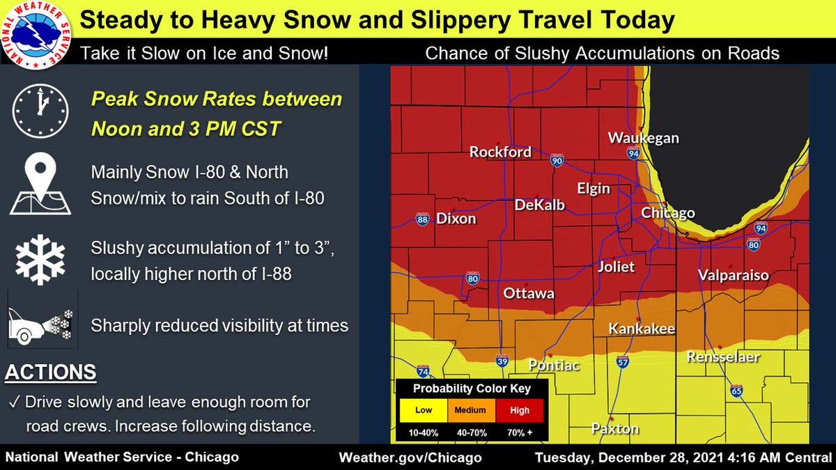
According to the weather service, it will be mainly snow north of Interstate 80, and a rain and snow mix south of I-80.
Drivers should travel slowly and leave room for road crews, the weather service advised. It has been 287 days since the last measurable snowfall in Chicago, according to the weather service.
Find out what's happening in Mokenafor free with the latest updates from Patch.
Snow is also possible Wednesday afternoon and on Friday night, according to the weather service.
The area will see its first accumulating snow today. Another quick hitting disturbance will produce another period of wintry weather Wed night. Then, attention turns to the New Year's weekend when the area could see a winter storm move across the region. Stay tuned! #ilwx #inwx pic.twitter.com/oklrCBy5Gq
— NWS Chicago (@NWSChicago) December 28, 2021
Get more local news delivered straight to your inbox. Sign up for free Patch newsletters and alerts.