Seasonal & Holidays
Less Snow Now Expected for Much of Chicago Area on Christmas Eve
Less than a half-inch of total snow accumulation is predicted for Naperville.

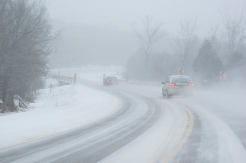
A threat for heavy snow over much of the Chicago area has diminished as a storm system is expected to track farther east than originally thought, according to the National Weather Service.
The powerful storm system will affect the Great Lakes region today with a winter weather advisory in affect for Cook, Will and Kankakee counties and Lake County in Indiana through 9 p.m.
Between one to four inches of wet snow is expected for that area with areas in northwest Indiana and near the Indiana border expecting more snow, according to the National Weather Service.
Find out what's happening in Napervillefor free with the latest updates from Patch.
Meanwhile, the majority of the Chicago area, including DuPage, Kane, McHenry and Lake Counties, is under a hazardous weather outlook. Rain is expected to develop this morning and could turn to snow in the afternoon.
“If it does change over to snow, some accumulations are possible, mainly east of interstate 55,” according to the National Weather Service.
Find out what's happening in Napervillefor free with the latest updates from Patch.
Less than a half-inch of snow is predicted for Naperville on Wednesday. Temperatures should reach a high of 36 and wind gusts of up to 20 mph are possible overnight.
Christmas Day temps should reach a high of 40 degrees with no snow in the forecast.
The above information was updated at 7 a.m. on Dec. 24.
------------
POSTED AT 4 P.M. on DEC. 23: A winter storm watch has been issued for communities throughout northeastern Illinois for Christmas Eve.
The National Weather Service has issued a winter storm watch for Kane, DuPage, Will, Cook, Kendall, Grundy, Kankakee counties and Lake County in Indiana from 9 a.m. to 9 p.m. Wednesday.
Wet snow is expected to begin to fall during the mid-morning hours with a band of heavy, wet snow expected to form somewhere over the watch area around noon through the early afternoon, according to the National Weather Service.
Light to moderate snow is then expected into the early evening.
Between three to seven inches of total snow is expected with higher amounts possible in areas hardest hit by the storm.
Between one to two inches of snow could fall per hour with more than two inches of snow expected to fall per hour in a narrow band of heavy snow expected to affect a portion of the watch area.
In addition, wind gusts between 15 to 20 mph are expected with wind gusts up to 30 mph possible.
Travel will be difficult and nearly impossible for those traveling where the band of heavy snow hits. Visibility will vary from one mile to less than 1/4-mile.
The heavy, wet snow will also be difficult to shovel, according to the National Weather Service.
Meanwhile, a winter weather advisory has been issued for Lake, DeKalb and McHenry counties where the storm is expected to be less severe. Between two to five inches of snow is expected for the advisory area.
ALSO ON PATCH
Get more local news delivered straight to your inbox. Sign up for free Patch newsletters and alerts.