Politics & Government
What Is The Village Doing To Keep Water Out Of Your Basement?
A proposal for improving flood controls will be presented to the public works committee on Aug. 30.


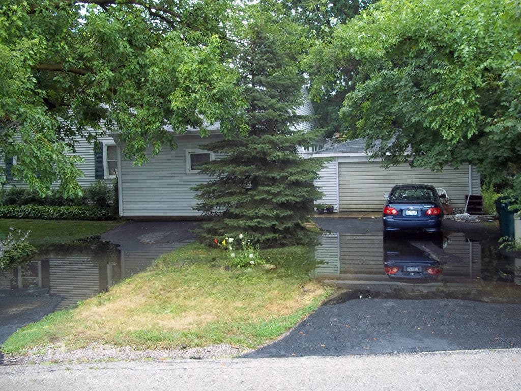

If you’ve lived in certain neighborhoods in Northbrook for any length of time, you’re probably all too familiar with flooded basements, rainwater blocking the roadway and pooling water creeping up your driveway.
Residents of Canterbury Drive and Sunnyside Circle, in particular, have been especially hard hit lately. After a couple of very , piles of sodden rugs and soaked furniture could be seen lining both of those streets.
said Bari Rosenbloom, a resident of Canterbury Drive.
Find out what's happening in Northbrookfor free with the latest updates from Patch.
Related:
“Please do something. I’m begging you,” she told the village board at last week’s meeting.
Find out what's happening in Northbrookfor free with the latest updates from Patch.
So what is the village doing to address the flooding problem in Northbrook?
“The village has been spending a lot of money on stormwater management,” said Village Engineer Paul Kendzior. "We have done quite a few projects."
Northbrook has allocated $5.2 million toward stormwater management since 1994, including funding the first step in a two-phase project called the Techny Drain, according to Kendzior. In total, he estimates that the village will spend $6 million on the project that includes a network of stormwater channels and detention facility near .
Progress is slow, however, because the village must work to obtain easements from private landowners and cooperate with government agencies such as the Cook County Highway Department, Kendzior said. And the village’s stormwater fund is set up to support maintenance, not to finance serious capital projects.
While the village chips away at improvements to sewers and retention devices, the Stormwater Management Commission is working on a master plan for addressing flooding in the village. Its members, including current trustee and former commission member , have been working on the plan since May 2010, Kendzior said.
The plan was revised as old projects were accomplished and new ones could be added, and is based on several studies of different problem areas in the village. Commission members identified those areas based, in part, on the severe flooding caused by a storm that hit Northbrook in September 2008.
A map of the village created after that storm shows flood-prone areas in purple, which spiders heavily across the center of the map near Farnsworth Lane. Some of the worst-hit areas were in the region surrounding Farnsworth, in the quadrant bounded by Walters Avenue and Shermer, Pfingsten and Techny roads. Significant flooding also occurred at the intersection of Sunset Ridge and Whitfield roads, as well as on many of the streets in the neighborhood just north of that.
The Stormwater Management Commission will present its proposal to the Public Works Committee, which handles funding, at the latter board's Aug. 30 meeting. The plan identifies 22 flood-prone areas, according to Kendzior, and will be available for public viewing shortly before the meeting.
While the commission , the village pushed back the deadline due to the need for additional revisions. Ultimately, if the Public Works Committee approves the plan, it will go before the village board for a vote.
Meanwhile, residents of Canterbury Drive, Sunnyside Circle and other flood-prone streets are just hoping it doesn’t rain—or then again, maybe that it does.
“Once the storm season is over, everybody forgets about it,” said Tim Wolney, a resident of Sunnyside Circle. Perhaps, he said, another heavy rain would be just the ticket to bring the issue to the forefront of everyone’s minds.
“People have to complain or nothing will get done,” Wolney said.
The Aug. 30 meeting of the Public Works Committee is scheduled for 6 p.m. at .
Get more local news delivered straight to your inbox. Sign up for free Patch newsletters and alerts.