Community Corner
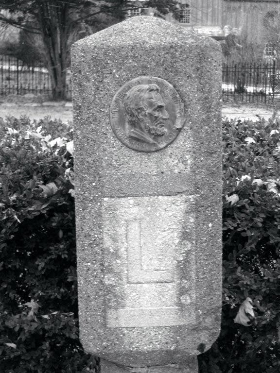
New Online Lincoln Highway Map Includes St. Charles
Google-powered interactive map highlights points of interest along nostalgic coast-to-coast highway that passes through Batavia, Geneva and southwestern St. Charles.


The Lincoln Highway Association is promoting the free use of an online map as it prepares to mark the 100th anniversary of the Lincoln Highway in 2013.
Billing it as a complete, definitive online map of the entire highway, from New York City to San Francisco, it is available on he Lincoln Highway Association's website, according to a release from the association. The online map represents more than 20 years of historical research and 10 years of mapping by more than 100 expert volunteers, the association said.
Keep track of the St. Charles Patch by "liking" us on Facebook page and following us on Twitter at @StCharlsILPatch.
Find out what's happening in St. Charlesfor free with the latest updates from Patch.
Named after Abraham Lincoln, the highway marks its centennial in 2013, when the association expects to see flocks of car clubs and families make the 14-state trek along the nation's first coast-to-coast improved road.
The association's online map is powered by Google’s interactive mapping software, which offers shows satellite and street views of the Lincoln Highway and its myriad points of interest. The association describes it as the first detailed mapping of the entire Lincoln Highway, including several generations points of interest. Map users can zoom in to trace the Lincoln Highway and check the “Points of Interest” button to view places to see along the road.
Find out what's happening in St. Charlesfor free with the latest updates from Patch.
To view the map, go to www.lincolnhighwayassociation.org/map.
Do you have your own photos of the Lincoln Highway's sights? Upload them here so other St. Charles and Geneva Patch readers can enjoy your handiwork. It's easy!
Get more local news delivered straight to your inbox. Sign up for free Patch newsletters and alerts.