Politics & Government
Yorkville Historical Marker To Commemorate Original IL Boundary
The historical marker will be installed this summer at Town Square at the same latitude as the original proposed state boundary.


YORKVILLE, IL — The Yorkville City Council last week signed off on a historical marker indicating the one-time proposed Illinois border for a Yorkville park. The 44-by-51-inch cast aluminum marker will be installed this summer at Town Square, city officials said.
In honor of this year's Illinois Bicentennial, the marker will commemorate what was at one time proposed to be the northernmost boundary of the state.
A memo from Director of Parks and Recreation Tim Evans to the board proposed the marker be installed at the Van Emmon Center, noting, "The marker celebrates Illinois Bicentennial (1818‐2018) and commemorates what was to be Illinois’ northern boundary, a line running east‐west along the southern extreme of Lake Michigan at about 41°38’ north latitude."
Find out what's happening in Yorkvillefor free with the latest updates from Patch.
According to the memo, the Van Emmon Activity Center falls within that latitude, but a proposal from Crystal Lake resident Mary Alice Feller — who suggested installing the marker — proposed it be installed at Town Square, also on the same latitude. Feller is donating $3,400 for the marker and eight-foot aluminum pole.
At a May 8 city council meeting, the proposal was amended to locate the marker at Town Square and approved by the city council.
Find out what's happening in Yorkvillefor free with the latest updates from Patch.
Feller filed an application with the Illinois State Historical Society to place the marker in Town Square.
A draft of the marker's text notes that the originally proposed northern boundary of Illinois — way back in 1787 — was parallel to the southern tip of Lake Michigan. While legislation to admit Illinois into the Union was pending in the House, that boundary was still part of the proposed bill. But before Illinois became the 21st state, its delegate to the U.S. House of Representatives, Nathaniel Pope, proposed amending the boundary to include a portion of Lake Michigan.
A draft of the proposed text for the historical marker notes that Pope "felt the necessity of giving Illinois a firm footing on the lake thus committing her interest to northern commerce flowing through the lakes to offset the influence of southern trade on the Mississippi and Ohio rivers in case of internal conflict."
Adding part of Lake Michigan "would 'afford additional security to the perpetuity of the Union, inasmuch as the state would thereby be connected with the states of Indiana, Ohio, Pennsylvania, and New York, through the lakes," according to the draft. The change gave Illinois 61 miles of added territory, including 14 counties and 8,500 square miles of fertile soil, lake and river ports, and "future prosperous cities" including Chicago, Rockford, Freeport and Galena.
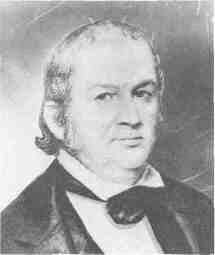
Pope's amended state boundary had even greater repercussions for the young nation, according to the text: "Politically, this additional northern territory decisively influenced Illinois in favor of national unity and against slavery during the Civil War period and was important in the nomination of Abraham Lincoln in 1860. Thus Pope's foresight had national repercussions as well as significance for Illinois."
Illinois officially became a state on Dec. 3, 1818.
Towns Square is located off Route 47 in the heart of Yorkville. Evans said installing the marker will cost the city $500. The city will also be responsible for the long-term maintenance of the marker and the site. A memo from Evans said the goal is to install the marker this summer, with a dedication ceremony by the end of July or first week of August.
Photo: Town Square via Google Maps Streetview
Get more local news delivered straight to your inbox. Sign up for free Patch newsletters and alerts.