Community Corner
Storm Clouds Roll Over West Des Moines Sunday Night
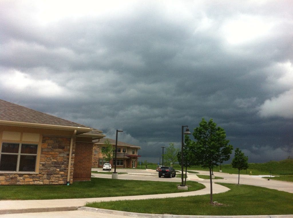
West Des Moines residents should keep their weather radios handy tonight, or download weather warning apps on their cell phones.

Dallas and Polk counties are under a tornado watch until 10 p.m. Sunday night, according to the National Weather Service.
The forecast calls for widespread thunderstorms early this evening across the area toward the northeast.
The Weather Service says "significant severe weather is expected with these storms later into the evening will all modes of severe weather."
Find out what's happening in West Des Moinesfor free with the latest updates from Patch.
Storms with rain and high wind blew through the metro area starting at about 7 p.m. The Dallas County Emergency Management Agency website had no damage updates Sunday night.
The Polk County Emergency Management Agency's Facebook page says that as of 8:45 p.m. there were: "Branches and trees down blocking the roadways; semi trucks pushed over on I-35 north of Ankeny; numerous power lines downed in the right-of-way and blocking travel lanes; ... Fences down near a pump station in Johnston, rain caused storm sewer surges and man hole covers displaced. ..."
Find out what's happening in West Des Moinesfor free with the latest updates from Patch.
Here's video of high winds bending trees over in Ankeny.
See any damage around West Des Moines? Have photos from the storm? Share them with your neighbors by clicking on "Upload Photos and Video."
Golf ball-size hail, damaging winds above 60 mph and a few tornadoes will be possible tonight, the forecasters say. Heavy rainfall at times may lead to ponding of water in urban areas.
The bumpy weather continues through early Wednesday, the Weather Service says, mainly Monday and Tuesday afternoons and evenings.
The storms will cool things off, says weather.com. After a high of 88 today, Monday's high will reach 80 degrees, look for a top temp of 76 on Tuesday, then relatively cool highs of 68 and 69 and Wednesday and Thursday, respectively.
Tornado Safety Rules
It's a good time to review these tornado safety tips from the Dallas County Emergency Management office.
In Homes, the basement offers the greatest safety. Seek shelter under sturdy furniture if possible. In homes without basements, take cover in the center part of the house, on the lowest floor, in a small room such as a closet or bathroom, or under sturdy furniture. Keep away from windows.
In Shopping Centers, go to a designated shelter area (not to your parked car).
In Office Buildings, go to an interior hallway on the lowest floor, or to the designated shelter area.
In Schools, follow advance plans to a designated shelter area, usually an interior hallway on the lowest floor. If the building is not of reinforced construction, go to a heavy one that is, or take cover outside on low, protected ground. Stay out of auditoriums, gymnasiums, and other structures with wide, free-span roofs.
In Automobiles, leave your car and seek shelter in a substantial nearby building, or lie flat in the nearest ditch or ravine.
In Open Country, lie flat in the nearest ditch or ravine.
Mobile Homes are particularly vulnerable and should be evacuated. Trailer parks should have a community storm shelter and a warden to monitor broadcasts throughout the severe storm emergency. If there is no shelter nearby, leave the trailer and take cover on low, protected ground.
Get more local news delivered straight to your inbox. Sign up for free Patch newsletters and alerts.