Weather
MD Weather: Flood Watch, Severe Thunderstorm Watch Issued
More heavy rain, with chances for severe storms, is moving into Maryland. Flood watches will kick in later today, here's what to expect.

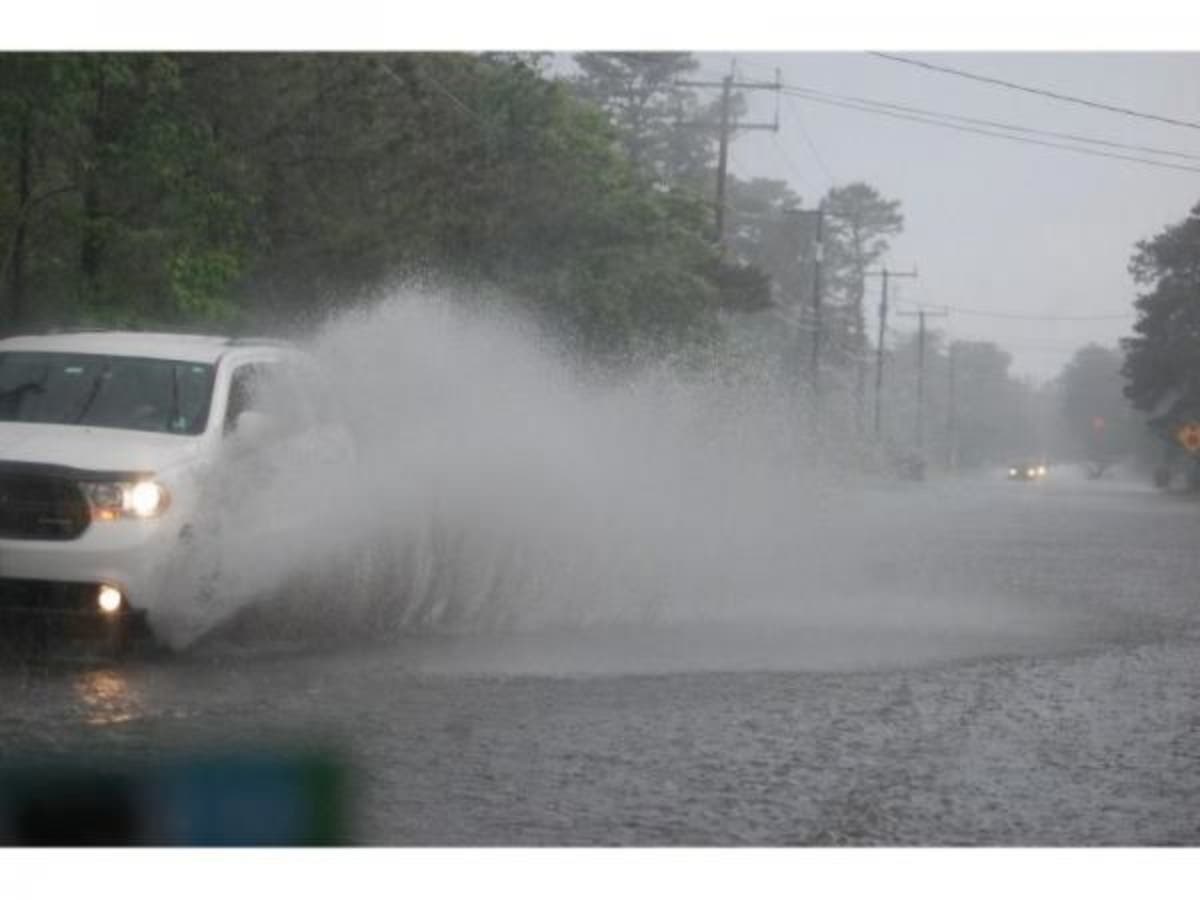
BALTIMORE, MD — The brief respite from rain will end Friday afternoon when another wave of thunderstorms moves across Maryland, weather forecasters say, bringing more risk of flooding, downed trees from the soaked soil, hail and strong winds. A new forecast suggests the state could get hammered by some "strong and severe storms" in the late afternoon and into the evening on Friday, and a flood watch goes into effect for much of the state at 3 p.m. Friday until 11 p.m.
A severe thunderstorm watch is in effect for the city of Baltimore, plus Anne Arundel, Baltimore, Calvert, Carroll Charles, Frederick, Harford, Howard, Montgomery, and Prince George's counties until 10 p.m. Friday.
The worst of it should be between 4 and 10 p.m. on Friday. A mostly sunny morning will give way to clouds that start building in the afternoon. "Showers and thunderstorms are expected this afternoon and evening as a cold front approaches the area. Both severe weather and flash flooding will be possible in association with these storms," the National Weather Service says.
Find out what's happening in Annapolisfor free with the latest updates from Patch.
Massive rainfall in Pennsylvania has prompted Exelon to open several gates at the Conowingo Dam to manage the increased flow of the Susquehanna River. The Maryland Department of Natural Resources reported that record amounts of rain have produced historic flows at the dam — more than 300,000 cubic feet per second — and warned people to avoid the water downstream.
"It is vitally important that anglers and boaters avoid the area downstream of the dam as heavy flows and accompanying marine debris – both submerged and superficial – can pose a serious threat to people and vessels," Maryland Natural Resources Secretary Mark Belton said in a statement Thursday evening.
Find out what's happening in Annapolisfor free with the latest updates from Patch.
The Friday evening rush hour could be slower than normal for people commuting home or heading to a weekend vacation destination in Washington, D.C., or Baltimore, according to AccuWeather.
The Washington Post's Capital Weather Gang says that the storm raises new concerns of flash flooding plus falling trees due to the soggy and unstable ground. There's also the threat of lightning, large hail, and powerful wind gusts.
"The siege of moist air, torrential rain and flooding is about to come to something of a pause in time for the weekend," they write. "But it does so with a grand finale of sorts, from strong to severe showers and thunderstorms ahead of an approaching cold front on Friday."
SEE ALSO: Conowingo Dam Gates Open
(For more news like this, find your local Patch here. If you have an iPhone, click here to get the free Patch iPhone app; download the free Patch Android app here. And like Patch on Facebook!)
The flood watch issued by the National Weather Service includes the District of Columbia, plus Carroll, Baltimore, Prince George's, Anne Arundel, Charles, Montgomery, and Howard counties. Cities in the watch are Washington, Eldersburg, Westminster, Reisterstown, Cockeysville, Baltimore, Bowie, Suitland-Silver Hill, Clinton, College Park, Greenbelt, Laurel, Camp Springs, Glen Burnie, Annapolis, Severn, South Gate, Severna Park, Arnold, Odenton, St. Charles, Waldorf, Germantown, Damascus, Bethesda, Rockville, Gaithersburg, Silver Spring, Lisbon, Columbia, Ellicott City, Jarrettsville, and Aberdeen.

So what about the weekend? It certainly looks better than this past week has been. Saturday may see a shower or two, but for the most part it should be sunny with fairly low humidity and temperatures in the mid-80s. On Sunday, it may be a little cloudy but the risk of rain is pretty low. It will feel even better than Saturday with slightly lower temperatures and even lower humidity.
Here's the forecast:
Friday: Showers and thunderstorms likely, mainly after 5pm. Partly sunny, with a high near 90. South wind 3 to 8 mph. Chance of precipitation is 60%. New rainfall amounts between a quarter and half of an inch possible.
Friday Night: Showers and thunderstorms before 11pm, then showers likely and possibly a thunderstorm between 11pm and 2am, then isolated showers and thunderstorms after 2am. Some of the storms could produce small hail, gusty winds, and heavy rain. Low around 71. South wind 5 to 7 mph becoming light and variable after midnight. Chance of precipitation is 80%. New rainfall amounts between a half and three quarters of an inch possible.
Saturday: Mostly sunny, with a high near 86. West wind 5 to 7 mph.
Saturday Night: Partly cloudy, with a low around 70. West wind around 5 mph becoming calm in the evening.
Sunday: Partly sunny, with a high near 85. Northeast wind around 6 mph becoming calm in the afternoon.
Sunday Night: A slight chance of showers. Mostly cloudy, with a low around 70. Chance of precipitation is 20%.
Monday: A chance of showers and thunderstorms. Partly sunny, with a high near 84. Chance of precipitation is 40%.
Image via Shutterstock, graphic via the National Weather Service
Get more local news delivered straight to your inbox. Sign up for free Patch newsletters and alerts.