Weather
Pre-Christmas Storm Threatens MD Travel Plans With Rain, Slight Chance Of Snow Then Cold
A pre-Christmas storm could disrupt Marylanders' travel plans. Arctic air brings a small chance of snow to the Mid-Atlantic later this week.


MARYLAND — A potential winter storm may disrupt Marylanders' Christmas travel plans later this week.
The Old Line State has a high chance of precipitation on Thursday and Friday.
The forecast currently calls for mostly rain. There's a chance, however, that a band of cold Arctic air could push down toward Maryland and change that to a wintry mix or snow.
Find out what's happening in Annapolisfor free with the latest updates from Patch.
AccuWeather predicted that the bubble of Arctic air may bring a blizzard to the Great Lakes and the Midwest from Thursday to Friday. A lesser amount of snow could accumulate from as far south as Arkansas to as far north as Maine along the Canadian border.
The most western parts of Maryland may see some of that snow accumulation, AccuWeather forecasted. Temperatures seem like they will be too high for any accumulation in central Maryland or on the Eastern Shore. Those areas are expecting mostly rain between Thursday and Friday.
Find out what's happening in Annapolisfor free with the latest updates from Patch.
"This storm will likely become intense, feeding on the extremely sharp variation between the surging arctic air arriving from the Central states and relatively warm air across the southeastern U.S.," AccuWeather Chief Meteorologist Jon Porter said. "Major East Coast storms over the decades have occurred in this type of setup, bringing the risk for heavy snow and rain, gusty winds, coastal flooding, severe thunderstorms and even tornadoes on the southern side of the storm."
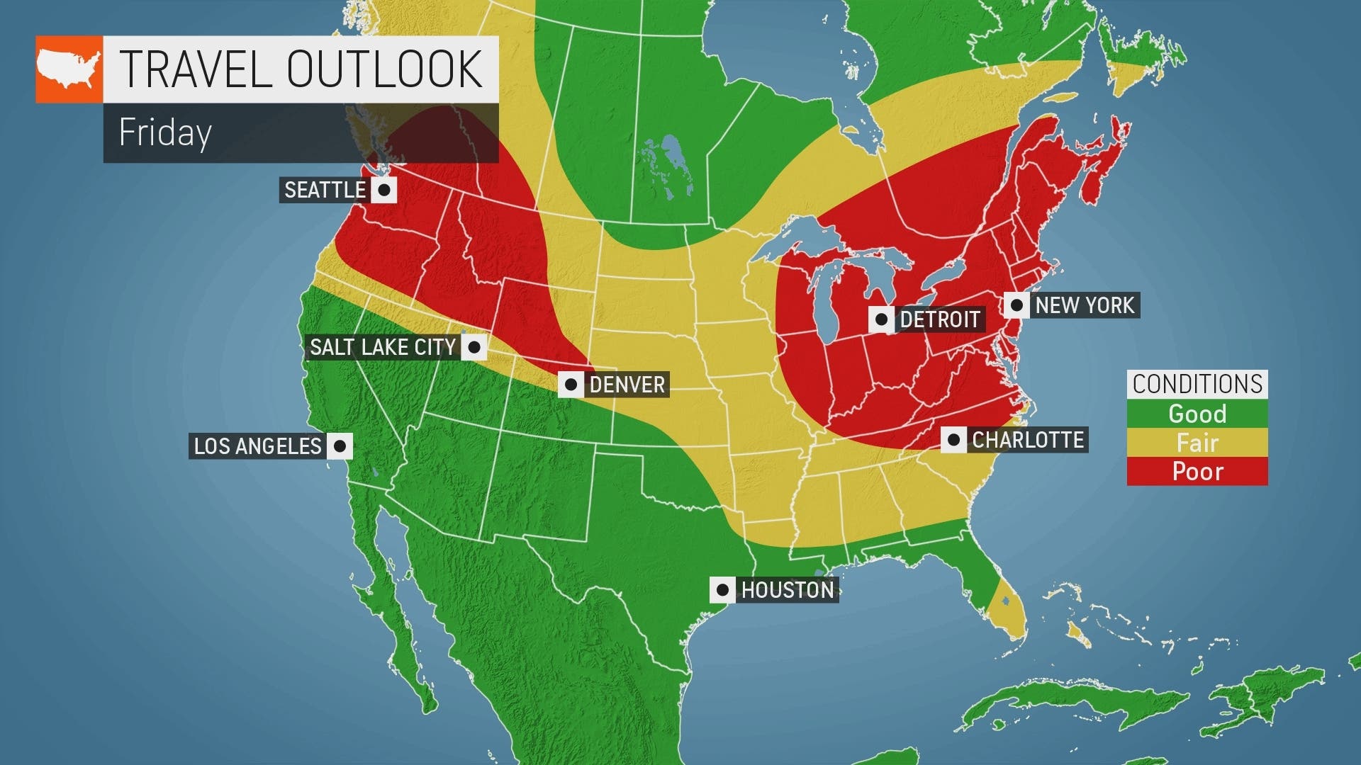
AccuWeather said this system may be complex. One storm may head toward the Great Lakes, while a second could form over the Appalachian Mountains or along the Atlantic Coast later this week.
That potential coastal storm will determine the fates of the District of Columbia, Baltimore, Philadelphia, New York City and Boston. Snow or a wintry mix are at least potentials in all of these cities, AccuWeather said.
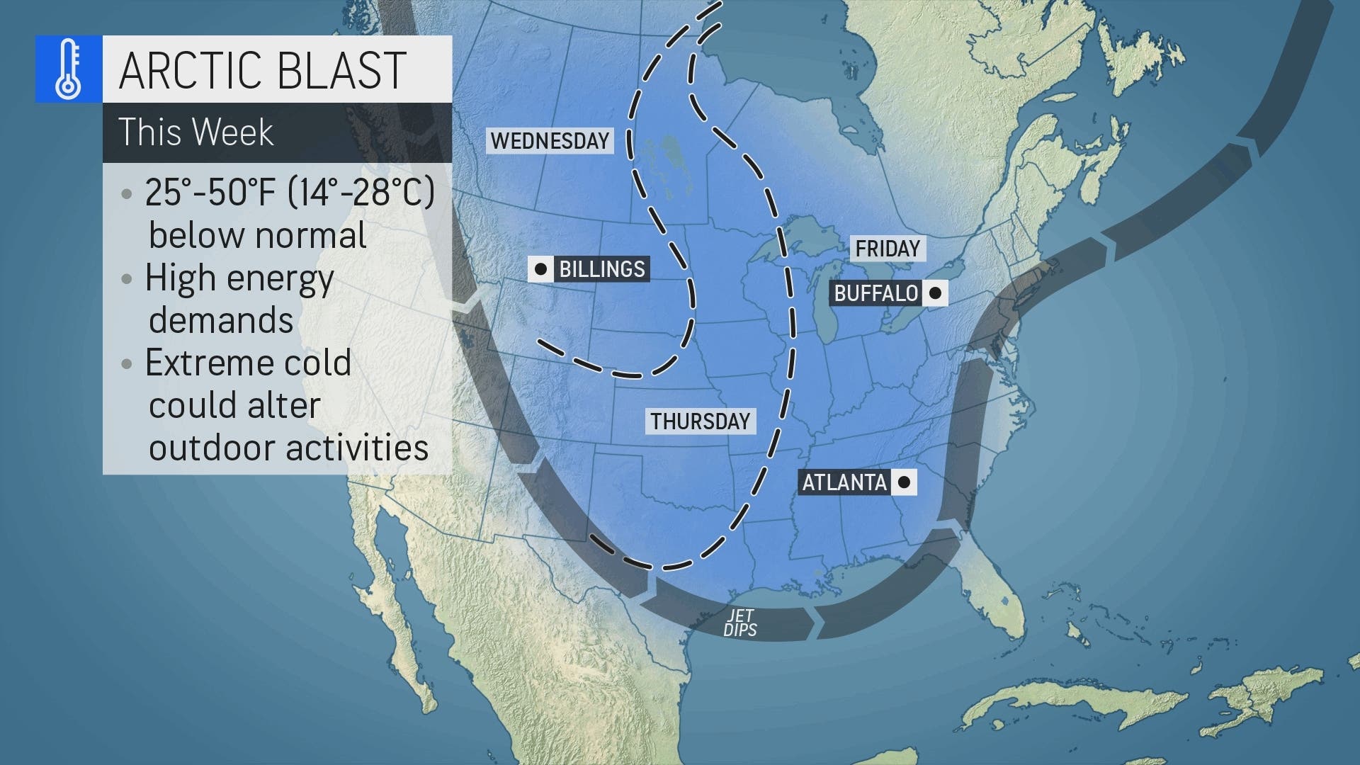
This week's Arctic blast will drop the jetstream lower into the U.S., bringing cold air to the East Coast later this week. Temperatures could be 25 to 50 degrees colder than normal in some states, AccuWeather forecasted.
The cold front shouldn't reach Maryland until this weekend. That means the odds of snow accumulation during the potential Thursday and Friday storm are currently lower along the Interstate 95 corridor.
Maryland temperatures could fall to the upper teens Friday night after the storm clears the area. Wet roads may freeze over if lower temperatures linger.
"The exact track of the storm will dictate which areas receive heavy snow versus heavy rain and the most significant impacts," Porter said. "People and businesses in the eastern U.S., especially those traveling, should be extra alert and frequently check AccuWeather forecasts this week to stay updated on expected impacts."
Poor weather could disrupt travel plans for the 2.2 million Marylanders who plan to drive at least 50 miles for Christmas and New Year's.
Related: Best, Worst Times To Get Out Of MD For Christmas, New Year's Travel
Forecast At BWI Airport
Here is the National Weather Service's forecast at Baltimore/Washington International Thurgood Marshall Airport in Linthicum.
Monday: Mostly sunny, with a high near 40. Northwest wind 14 to 16 mph, with gusts as high as 25 mph.
Monday Night: Partly cloudy, with a low around 25. Northwest wind around 6 mph.
Tuesday: Sunny, with a high near 42. Northwest wind 3 to 7 mph.
Tuesday Night: Partly cloudy, with a low around 25. Calm wind.
Wednesday: Mostly sunny, with a high near 46. Calm wind becoming northeast around 5 mph in the morning.
Wednesday Night: Cloudy, with a low around 31.
Thursday: Rain, mainly after 1pm. High near 51. Chance of precipitation is 90%.
Thursday Night: Rain. Low around 46. Breezy. Chance of precipitation is 90%.
Friday: Rain before 1pm, then a chance of rain and snow. High near 49. Breezy. Chance of precipitation is 90%.
Friday Night: Partly cloudy, with a low around 17. Windy.
Saturday: Sunny, with a high near 28. Breezy.
Saturday Night: Mostly clear, with a low around 14.
Christmas Day: Sunny, with a high near 29.
Read more about the potential storm and its path on AccuWeather.
Get more local news delivered straight to your inbox. Sign up for free Patch newsletters and alerts.